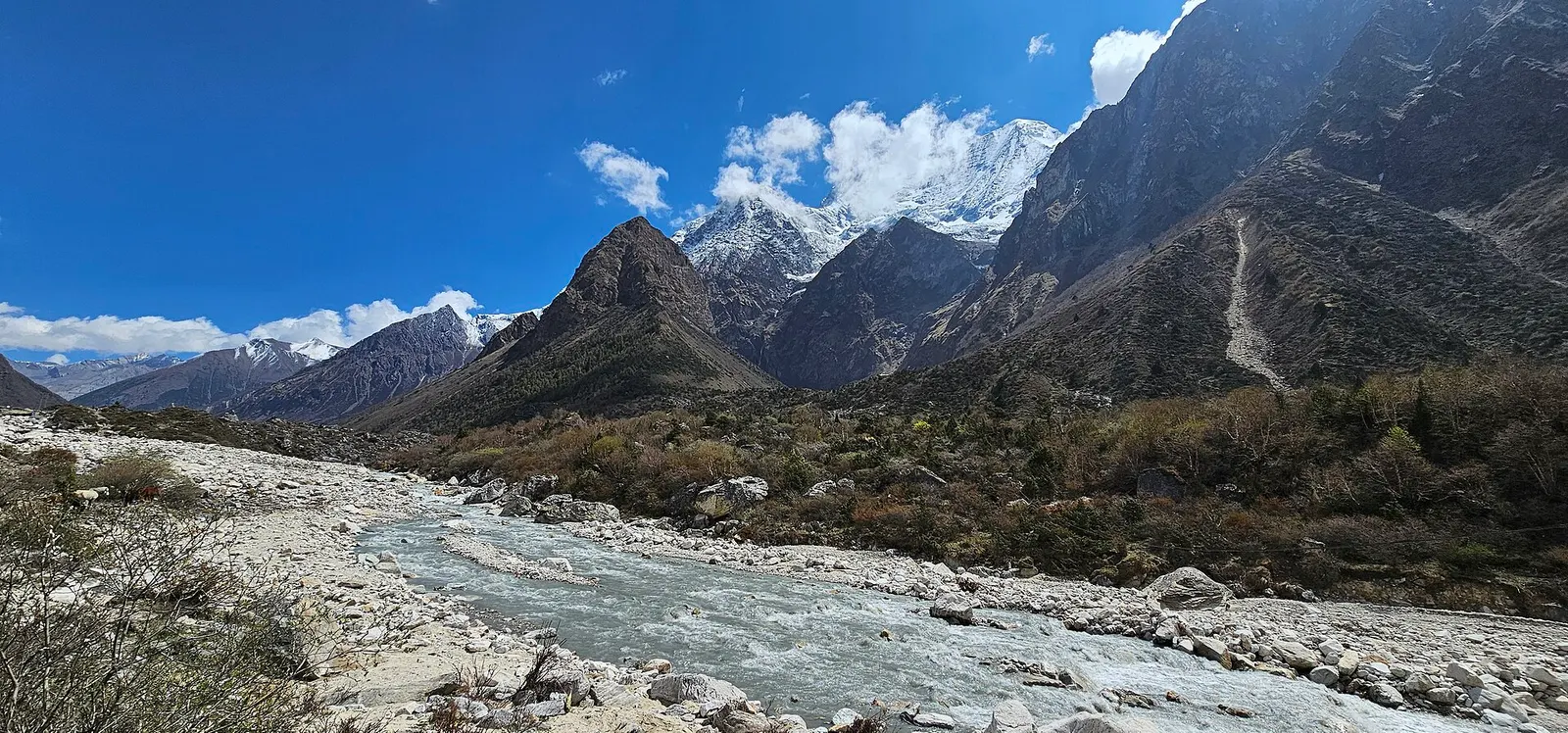


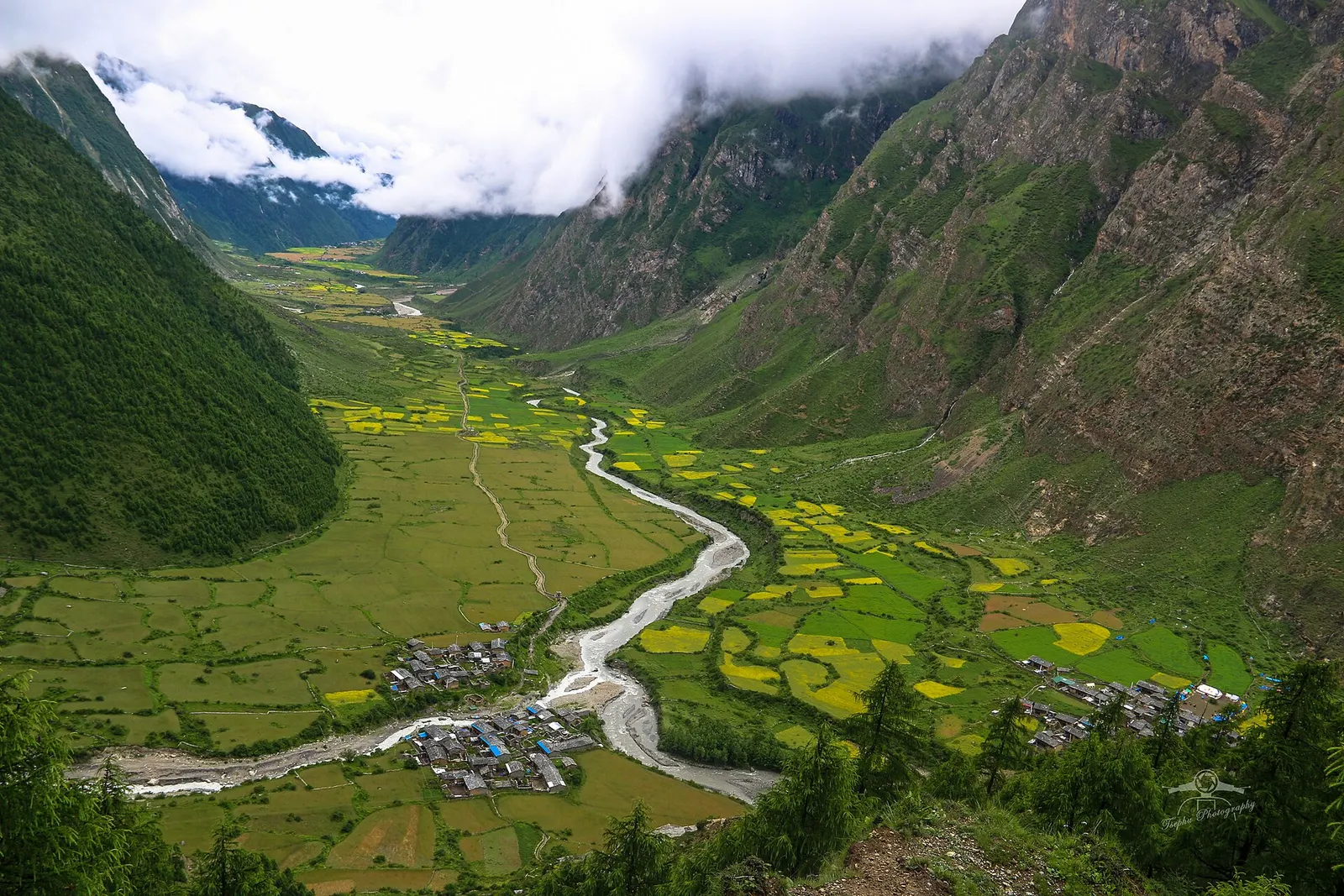
Valley or region
Tsum Valley
A restricted Buddhist side valley of the Manaslu region, with monasteries, Milarepa's cave and villages near the Tibetan border.
Pokhara & Annapurnaमनास्लु
A restricted trekking region around the world's eighth-highest mountain, from the Budhi Gandaki gorge to Tibetan-Buddhist villages and the Larkya La.
This is the Manaslu region of northern Gorkha district (the Manaslu Conservation Area, the Manaslu Circuit and the Tsum Valley), not only the 8,163 m mountain itself.
Higher seasonal exposure: altitude (All year), landslides (Jun-Sep), road blockages (Jun-Sep), river crossings (Jun-Sep), seasonal closure (Dec-Feb), snow (Dec-Mar), cold (Nov-Feb).
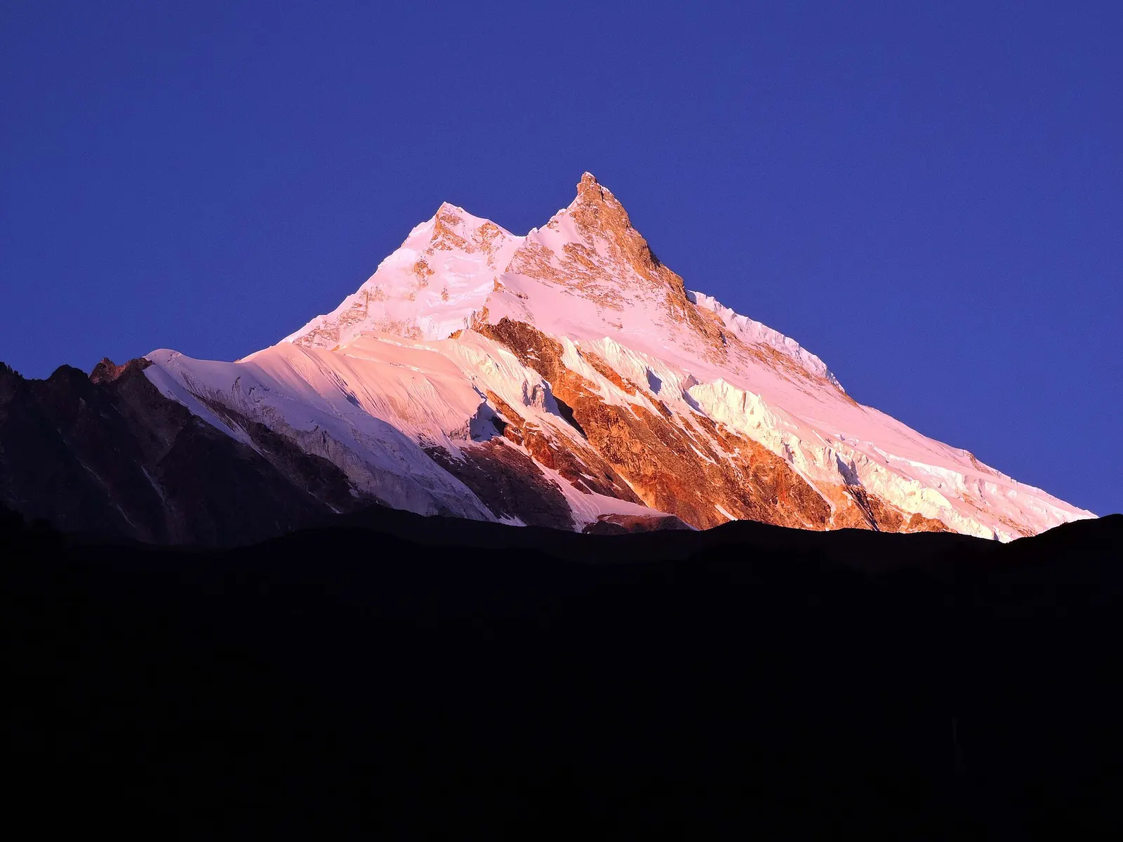
The Manaslu region covers the upper Budhi Gandaki valley in northern Gorkha district, around Manaslu (8,163 m), the eighth-highest mountain in the world. Most of it lies within the Manaslu Conservation Area, established in 1998 and managed by the National Trust for Nature Conservation. The landscape climbs from subtropical gorges with rice terraces and waterfalls to high yak pastures and glaciers near the Tibetan border.
Most visitors come for the Manaslu Circuit, a teahouse trek of about two weeks that follows an old salt-trading route up the Budhi Gandaki, crosses the Larkya La at 5,106 m and descends to the Marsyangdi valley, where it meets the Annapurna Circuit. Trekking here was opened to foreigners only in 1991 and the upper valley is still a restricted area, so it sees far fewer trekkers than the Annapurna or Everest regions.
Places in this destination: Soti Khola is the usual starting point on the river, and Machha Khola the first night's stop for many. The Larkya La is the high pass and the crux of the circuit. The Tsum Valley, a side valley that branches off near Lokpa, is a separate restricted area of Buddhist villages and monasteries, with its own pages for Lokpa, Chhokang Paro, Nile, Mu Gompa and Rachen Gompa.
Higher up the main valley, Gurung villages give way to the Tibetan-speaking Nubri villages of Namrung, Lho, Samagaon and Samdo, with mani walls, monasteries and close views of Manaslu.
Valley or region
A restricted Buddhist side valley of the Manaslu region, with monasteries, Milarepa's cave and villages near the Tibetan border.
Trek stop · 3,590 m
A meadow settlement below the Larkya La, the first stop after the crossing.
Trek stop · 1,860 m
A small village at the head of the lower gorge on the Manaslu Circuit.
Trek stop · 4,460 m
The seasonal stop at the foot of the Larkya La, used the night before the crossing.
Trek stop · 1,340 m
A stone-paved village in the Budhi Gandaki gorge where the Manaslu restricted area begins.
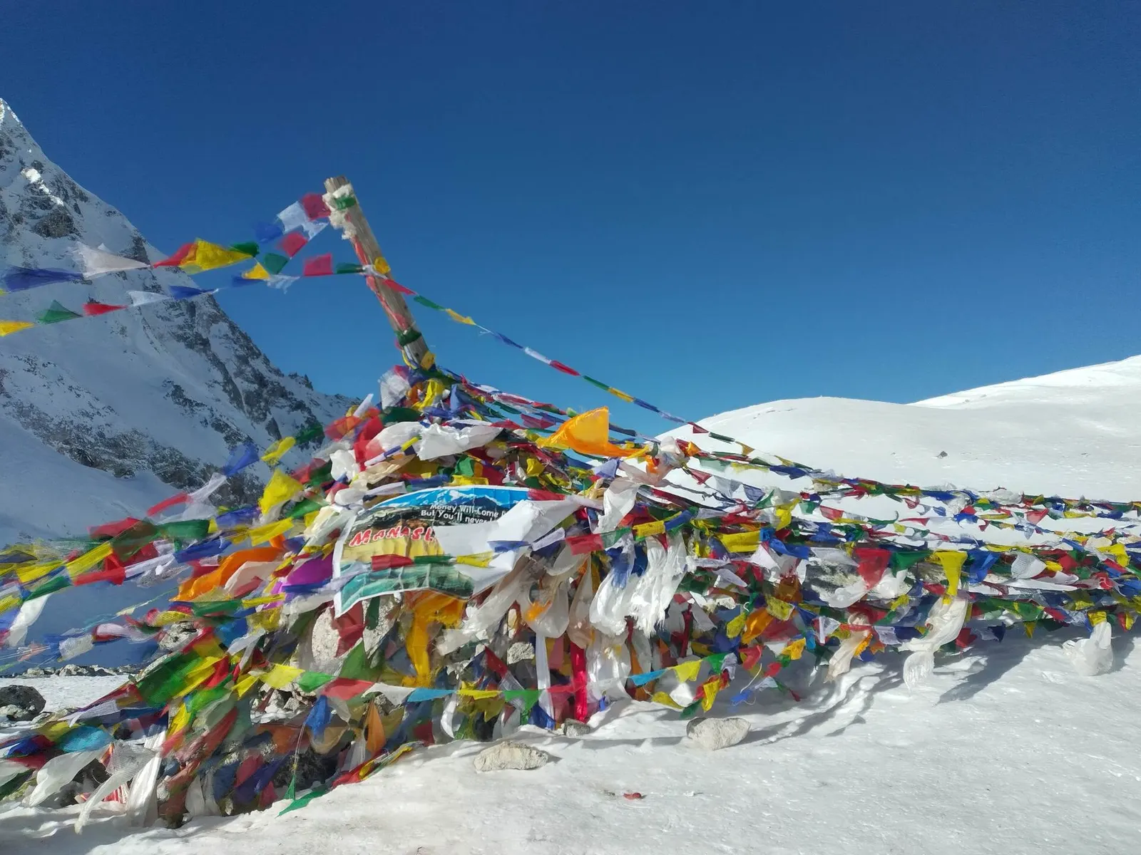
Mountain pass · 5,106 m
The high pass of the Manaslu Circuit, a long glacial crossing from the Budhi Gandaki to the Marsyangdi side.
Trek stop · 900 m
A riverside village of lodges at the mouth of a side stream, the first night's stop for most Manaslu Circuit trekkers.
Trek stop · 2,630 m
The first village of Nubri on the Manaslu Circuit, among barley fields and forest.
Trek stop · 1,570 m
A large Gurung village on the lower Manaslu Circuit, near the turn-off for the Tsum Valley.
Trek stop · 3,530 m
The main village of Nubri, below Manaslu, and the usual acclimatisation stop on the circuit.
Trek stop · 3,860 m
The last permanent village below the Larkya La, close to the Tibetan border.
Trek stop · 730 m
A small roadhead settlement on the Budhi Gandaki where most Manaslu Circuit treks begin.
The Budhi Gandaki was for centuries a trade route between Tibet and the middle hills, carrying salt and wool south and grain north. The lower valley is home to Gurung and other hill communities; the upper valley, known as Nubri ('western mountains'), and the Tsum Valley are settled by people of Tibetan language and culture who follow Tibetan Buddhism. Manaslu was first climbed in 1956 by a Japanese expedition, and the mountain's name is usually explained as coming from the Sanskrit manasa, 'soul' or 'intellect'.
Monasteries such as Pungyen Gompa near Samagaon and Mu Gompa in the Tsum Valley are centres of religious life, and the Tsum Valley is regarded in Tibetan Buddhism as a beyul, a hidden valley of refuge linked with the yogi Milarepa. The conservation area protects snow leopards, musk deer, Himalayan tahr and blue sheep.
Trek the Manaslu Circuit
About 12-16 days from Soti Khola up the Budhi Gandaki, over the Larkya La and down to Dharapani and Besisahar.
Add the Tsum Valley
Branch off at Lokpa for 6-8 extra days into the Tsum Valley to Mu Gompa near the Tibetan border.
Acclimatise at Samagaon
Spend a rest day hiking to Birendra Lake, Pungyen Gompa or towards Manaslu Base Camp.
Link with the Annapurna Circuit
Continue from Dharapani up the Marsyangdi to Manang and the Thorong La for a longer journey.
Forecast for 3,773 m. Conditions change fast in the mountains.
Weather data: MET Norway, licensed CC BY 4.0. A forecast, not a guarantee.
Mar-May, Oct-Nov
Family-run teahouses all along the circuit, simpler than on the Annapurna Circuit; Dharamsala (Larke Phedi) below the pass is very basic.
No partner stays are listed here yet. List a property.
Drive from Kathmandu via Dhading Besi or Gorkha to Arughat and on to Soti Khola or Machha Khola, then walk. The circuit ends at Dharapani or Besisahar on the Annapurna side.
Nearest hub: Kathmandu
Nearest hub: Kathmandu. Times are typical ranges, not schedules, and vary with roadworks, weather and the season.
By busfrom Kathmanduabout 7-9 hLocal buses
Public buses run from Kathmandu towards Arughat and Soti Khola in a long day on a road that is largely unpaved beyond Arughat; services may stop short of Soti Khola depending on the state of the track, with Arughat the usual fallback for a night.
When to set off: buses for Arughat and Soti Khola leave Kathmandu in the morning, so be at the bus park by about 07:00
By car or jeepfrom Kathmanduabout 7-10 h
A hired jeep is the usual way in: sealed road as far as Dhading Besi or Gorkha, then an unpaved hill road through Arughat to Soti Khola, and on up the valley to Machha Khola when the track allows.
Road: Sealed to Dhading Besi or Gorkha, then a largely unpaved hill road through Arughat; a jeep or 4WD is normally needed and the upper sections are monsoon-affected.
When to set off: leave Kathmandu by about 06:00 to reach the roadhead in daylight
By motorbikefrom Kathmanduabout 8-11 hExperienced riders only
Riders do reach the Manaslu roadhead, but the stretch beyond Arughat is rough, dusty and exposed, with river crossings and loose surfaces, so it suits experienced off-road riders only.
Road: Highway to Dhading Besi, then an unpaved hill road with loose gravel, steep pitches and stream crossings beyond Arughat.
When to set off: start early; the unpaved section beyond Arughat is slow going
On footfrom Soti Khola12-14 walking days Soti Khola to Dharapani over the Larkya La, longer with acclimatisation days and the Tsum Valley side trip
The circuit is walked from the Budhi Gandaki roadhead to the Marsyangdi, so the whole region is a trek rather than a day trip.
Restricted-area permit
The upper Budhi Gandaki (from around Jagat) and the Tsum Valley are restricted areas. Foreigners need a restricted area permit through a registered agency, a Manaslu Conservation Area permit and, to exit via the Marsyangdi, an Annapurna Conservation Area permit.
Verify before travel: permit rules and fees change. Checked 2026-10-06 against Department of Immigration: Trekking route and permit fee.
What this place is typically exposed to, and when. These are seasonal patterns, not a report on conditions now.
Altitudehigh in a typical yearAll year
At roughly 3,000-5,106 m on the circuit, thin air affects most people. General information, not medical advice: gain height slowly, build in acclimatisation days, learn the symptoms of altitude sickness (headache, nausea, breathlessness, broken sleep) and go down if they get worse. See a doctor before travelling and carry insurance that covers helicopter evacuation.
Landslideshigh in a typical yearJun-Sep
The Budhi Gandaki gorge is one of the more landslide-prone trekking corridors in Nepal and the monsoon months of June to September are generally avoided because of rain-slicked trails and slope failures.
Road blockageshigh in a typical yearJun-Sep
The largely unpaved road beyond Arughat is prone to landslide blockages and washouts during the June to September monsoon, when most of Nepal's annual rain falls.
River crossingshigh in a typical yearJun-Sep
The route crosses the Budhi Gandaki repeatedly on suspension bridges, and near Yaru a cantilever walkway carries the trail along the gorge wall. These are the most exposed sections when the river runs high in the monsoon.
Seasonal closurehigh in a typical yearDec-Feb
Heavy snow often blocks the Larkya La in deep winter and many upper lodges shut for the season, so the crossing is rarely attempted between December and February.
Snowhigh in a typical yearDec-Mar
Heavy snow lies on the Larkya La and the upper Nubri villages through the winter and into March, and upper lodges are seasonal.
Coldhigh in a typical yearNov-Feb
Nights are below freezing above about 3,500 m in both trekking seasons and far colder in winter.
Othermoderate in a typical yearJun-Aug
Leeches are common on the forested lower trail through the monsoon, which is one reason most trekkers avoid these months.
Check current conditions before you travel
Roads, trails, passes and flights change with the weather and with roadworks, and nothing on this page describes conditions today. Before you set off, check the Department of Hydrology and Meteorology for weather and flood warnings, the Nepal Disaster Risk Reduction Portal for incidents, and the local authority, police or your licensed operator for road, trail and flight status.
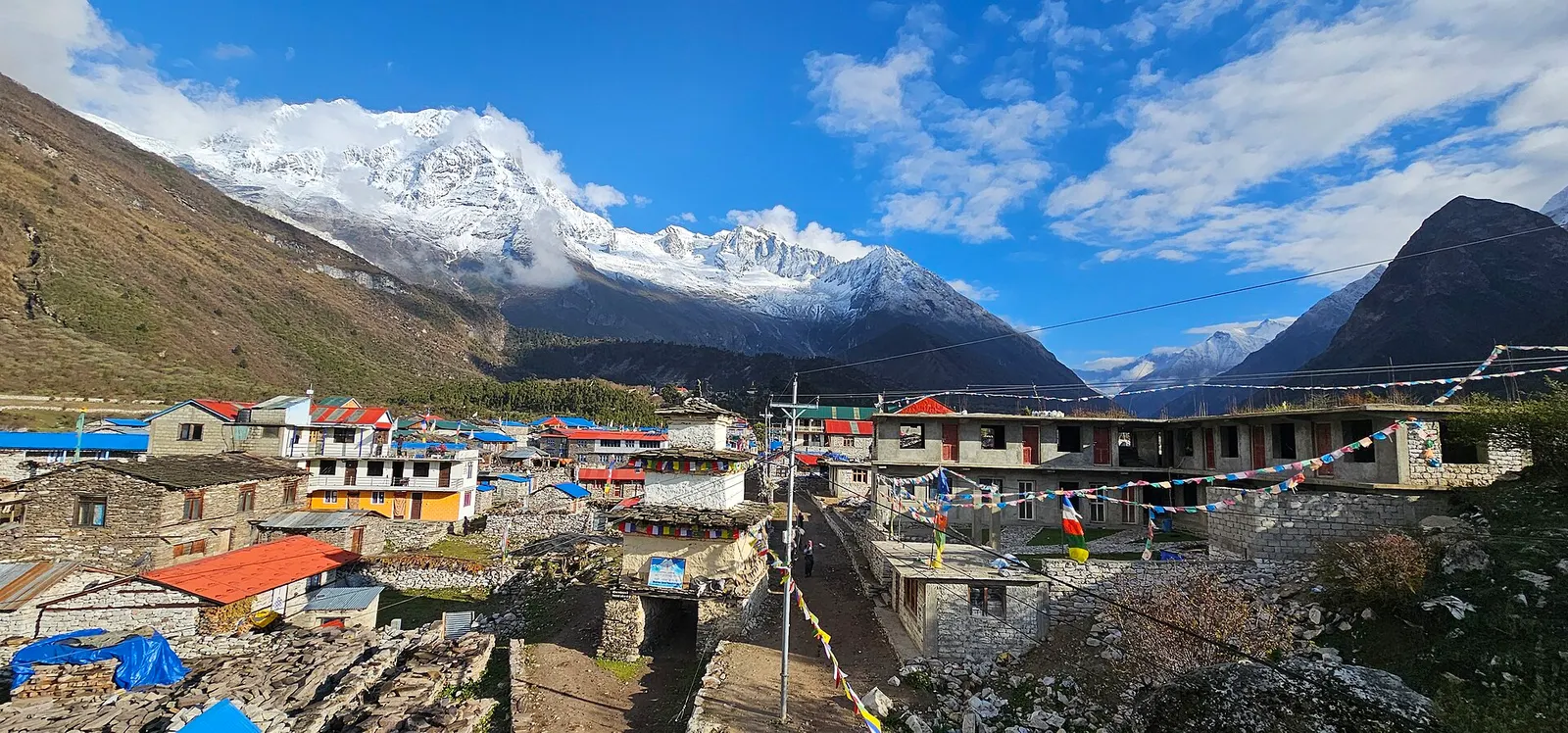
A restricted-area teahouse trek around Manaslu (8,163 m), up the Budhi Gandaki gorge through Gurung and Nubri villages, over the Larkya La (about 5,106 m) and down to Dharapani on the Annapurna Circuit.
Yes. The upper valley is a restricted area, so you need a restricted area permit through a registered agency, plus Manaslu and Annapurna conservation area permits. Check current fees and guide rules before you book.
Take a bus or jeep to Arughat and Soti Khola, roughly 7-9 hours, or on to Machha Khola when the road allows.
Most itineraries take about 12-16 days from Soti Khola to Dharapani, including acclimatisation days, and 6-8 days more with the Tsum Valley.
October and November, then March to May. Winter snow often closes the Larkya La, and the monsoon brings leeches and landslides.
Valley or region
A restricted Buddhist side valley of the Manaslu region, with monasteries, Milarepa's cave and villages near the Tibetan border.
Mountain pass · 5,106 m
The high pass of the Manaslu Circuit, a long glacial crossing from the Budhi Gandaki to the Marsyangdi side.
Trek stop · 730 m
A small roadhead settlement on the Budhi Gandaki where most Manaslu Circuit treks begin.
Trek stop · 900 m
A riverside village of lodges at the mouth of a side stream, the first night's stop for most Manaslu Circuit trekkers.