Skip to content

Tsum Valleyलोक्पा

Lokpa

A small village above the Budhi Gandaki where the trail turns east into the Tsum Valley.

This is Lokpa (Lokpha), the small village in Chumnubri, Gorkha, where the trail to the Tsum Valley leaves the Manaslu Circuit; not the Lokpa language of West Africa or any other place of that name.

Plan a trip here
Altitude
2,240 m*
Best months
Mar-May, Oct-Nov
Type
Trek stop
District
Gorkha, Gandaki
Permit
Restricted-area permit

Higher seasonal exposure: landslides (Jun-Sep), river crossings (Jun-Sep).

Why go

Lokpa is the first village of the Tsum Valley and the place where trekkers leave the main Manaslu Circuit. The trail branches off the Budhi Gandaki route north of Philim and Ekle Bhatti, climbs to a set of terraced fields and a few houses at about 2,240 m, and from here heads east into the forested gorge of the Shiar Khola, the river of Tsum.

As a stop it is small and simple, with a few lodges and homestays, but it marks a clear change: the Tsum restricted area begins around here, the number of trekkers drops, and the next days lead to Chumling and the Buddhist villages of the upper valley. Within the Tsum Valley page it is the gateway village; the main sights lie further up.

Views from Lokpa look back down the Budhi Gandaki and up to the forested ridges that separate it from the main Manaslu valley.

History and culture

Lokpa sits in Chumnubri Rural Municipality, the local government covering Tsum and Nubri. People here are of Tibetan-Buddhist culture, with chortens and prayer flags at the edge of the village. The Department of Immigration lists Lokpa among the settlements covered by the Tsum Valley restricted area permit.

Things to do in Lokpa

  • Head into Tsum

    Continue east through forest and across the Shiar Khola to Chumling, about 4-6 hours.

  • Rejoin the circuit

    On the way out of Tsum, return via Lokpa to the Budhi Gandaki and continue north towards Deng and Namrung.

Weather and the best time to visit Lokpa

Weather in Lokpa

Forecast for 2,240 m. Conditions change fast in the mountains.

Weather data: MET Norway, licensed CC BY 4.0. A forecast, not a guarantee.

Best time to visit

Mar-May, Oct-Nov

  1. Jan
  2. Feb
  3. Good month: Mar
  4. Good month: Apr
  5. Good month: May
  6. Jun
  7. Jul
  8. Aug
  9. Sep
  10. Good month: Oct
  11. Good month: Nov
  12. Dec
Autumn (Sep-Nov)
October and November are clear and dry.
Winter (Dec-Feb)
December to February is cold but usually passable at this altitude.
Spring (Mar-May)
March to May is mild, with rhododendrons in the forest.
Monsoon (Jun-Aug)
June to August brings rain, leeches and landslide risk on the approach trails.

Where to stay

TeahousesHomestays

A few simple lodges and homestays; book through your agency in peak season.

No partner stays are listed here yet. List a property.

Getting there

Walk up the Budhi Gandaki from Machha Khola via Jagat and Philim, about 2 days.

Nearest hub: Machha Khola (Manaslu Circuit)

  • trekJagat to Philim, then on via Ekle Bhatti to Lokpa, roughly 1-1.5 days from Jagat.
  • roadKathmandu to Machha Khola by jeep, roughly 8-10 hours, as the start of the walk.

Getting to Lokpa, by mode

Nearest hub: Machha Khola. Times are typical ranges, not schedules, and vary with roadworks, weather and the season.

  • On footfrom Philimabout 4-5 h4-5 h from Philim, climbing from roughly 1,570 m to 2,240 m through forest and across the Budhi Gandaki

    On foot only. Lokpa is the junction where the Tsum Valley trail leaves the Manaslu Circuit.

    Manaslu Trek, Wikivoyage

Where people go next

  • Chumlingon foot, about 4-6 hInto the Tsum Valley through forest along the Shiar Khola.
  • Philimon foot, about 3-4 hBack down to the Budhi Gandaki trail.
  • Dengon footRejoin the Manaslu Circuit northwards instead of turning into Tsum.
Mount Everest 8,848.86Kangchenjunga 8,586Dhaulagiri I 8,167Manaslu 8,163Annapurna I 8,091LokpaKathmandu
Boundary: Government of Nepal, Survey Department (2020). Peak data: Wikidata.

Permits and fees

Restricted-area permit

Lokpa is covered by the Tsum Valley restricted area permit. Foreigners also need the Manaslu Conservation Area permit and, to reach it on the circuit, the Manaslu restricted area permit; all arranged through a registered agency.

  • Tsum Valley restricted area permit: Covers Lokpa and the rest of Tsum; see the Tsum Valley page for the fee listed by the Department of Immigration.
  • Manaslu Conservation Area permit: Required in the conservation area.

Verify before travel: permit rules and fees change. Checked 2026-10-06 against Department of Immigration: Trekking route and permit fee.

On the trail

On the Tsum Valley Trek, Manaslu Circuit with Tsum Valley.

Previous stop:
Philim or Jagat
Next stop:
Chumling
A typical day:
Philim to Lokpa takes about 4-5 hours, climbing from roughly 1,570 m to 2,240 m through forest and over the Budhi Gandaki.

Risks and conditions

Seasonal risks around Lokpa

What this place is typically exposed to, and when. These are seasonal patterns, not a report on conditions now.

  • Landslideshigh in a typical yearJun-Sep

    The approach up the Budhi Gandaki and the forested lower Tsum trail are landslide-prone in the June to September monsoon; the upper valley is drier but the way in is the problem.

    Manaslu Trek, Wikivoyage

  • River crossingshigh in a typical yearJun-Sep

    The route crosses the Budhi Gandaki repeatedly on suspension bridges, and near Yaru a cantilever walkway carries the trail along the gorge wall. These are the most exposed sections when the river runs high in the monsoon.

    Manaslu Trek, Wikivoyage

  • Othermoderate in a typical yearJun-Aug

    Leeches are common on the forested lower trail through the monsoon, which is one reason most trekkers avoid these months.

    Manaslu Trek, Wikivoyage

  • Coldmoderate in a typical yearDec-Feb

    Cold but usually passable at about 2,240 m, with occasional snow in midwinter.

    Manaslu Trek, Wikivoyage

Check current conditions before you travel

Roads, trails, passes and flights change with the weather and with roadworks, and nothing on this page describes conditions today. Before you set off, check the Department of Hydrology and Meteorology for weather and flood warnings, the Nepal Disaster Risk Reduction Portal for incidents, and the local authority, police or your licensed operator for road, trail and flight status.

Practical tips

  • Carry cash for the whole Tsum trek; there are no ATMs.
  • Mobile signal is weak or absent.
  • Treat drinking water; the lodges sell boiled water.
  • Walk clockwise around chortens and do not remove prayer flags or mani stones.

Treks through Lokpa

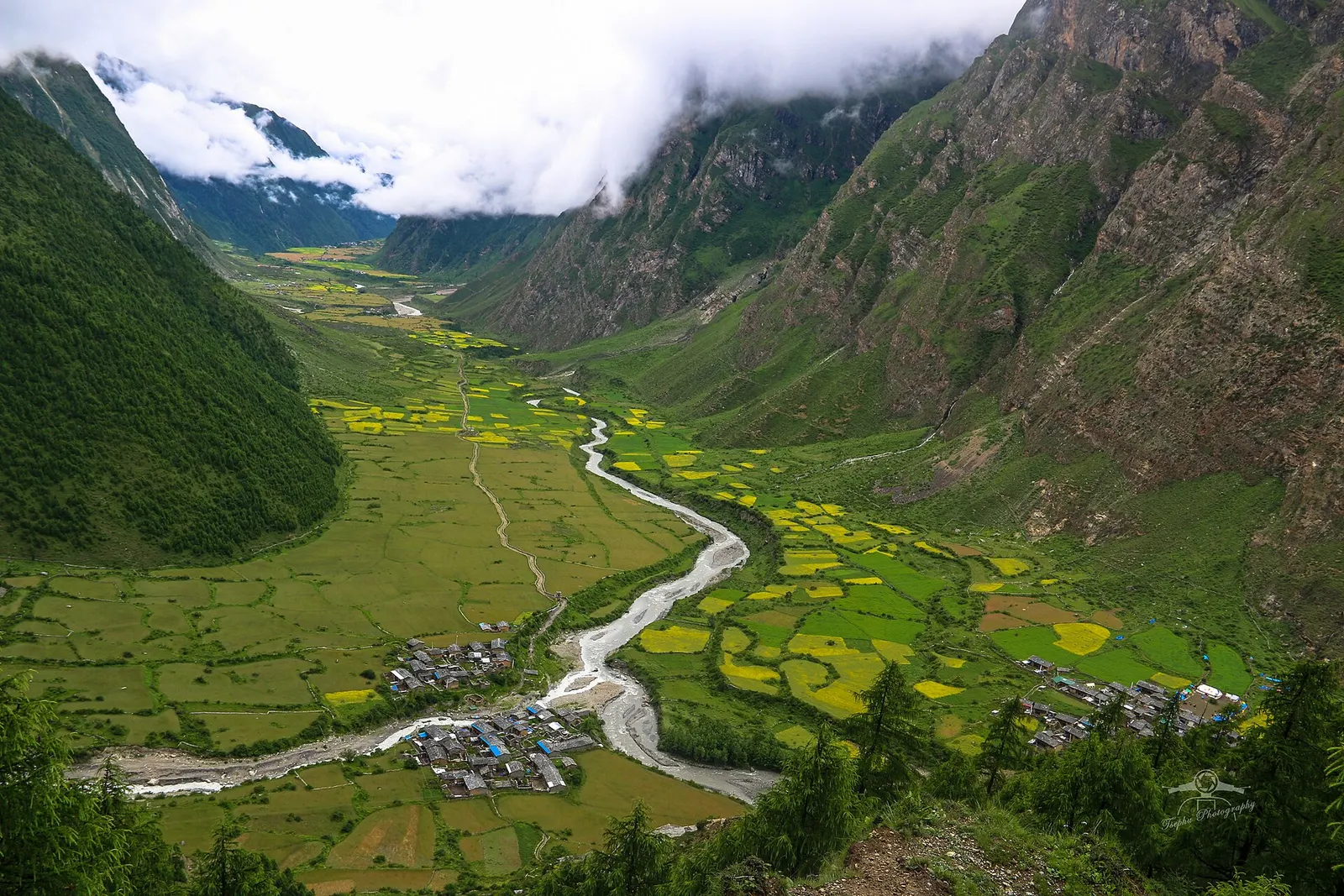
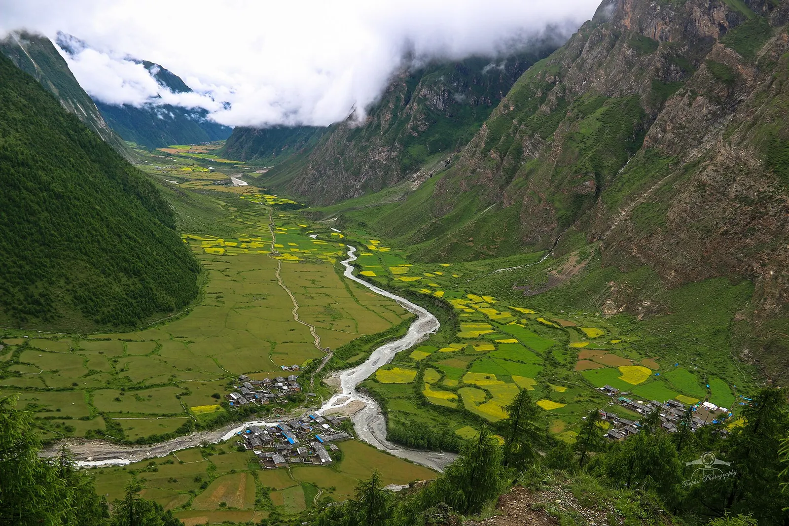
A braided river winds through green and yellow fields in the upper Tsum Valley, with two clusters of stone villages and steep cloud-capped slopes on either side.

A restricted-area trek from the Budhi Gandaki into the Buddhist Tsum Valley in northern Gorkha, through Chumling, Chhokang Paro and Nile to Mu Gompa (about 3,700 m) near the Tibetan border. Often combined with the Manaslu Circuit.

Days
12 days
Maximum altitude
3,700 m
Difficulty
Moderate

Questions about Lokpa

Where does the Tsum Valley trail start?

At Lokpa, a small village above the Budhi Gandaki north of Philim, where the trail turns east into Tsum.

Do I need a separate permit after Lokpa?

Yes. Lokpa and the rest of Tsum are covered by the Tsum Valley restricted area permit, separate from the Manaslu permit.

How far is Chumling from Lokpa?

Roughly 4-6 hours on foot through forest along the Shiar Khola.

More in Tsum Valley

All of Tsum Valley

Temple, monastery or heritage site · 3,700 m

Mu Gompa

The highest monastery of the Tsum Valley, set on a bare ridge near the Tibetan border at the head of the valley.

Temple, monastery or heritage site · 3,240 m

Rachen Gompa

A Buddhist nunnery on a terrace of the upper Tsum Valley, near Milarepa's cave and the villages of Chhokang Paro.

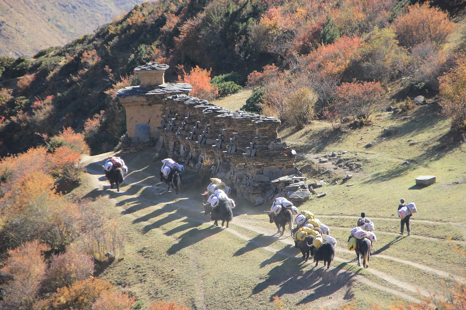
A mule caravan passing a long mani wall among autumn shrubs at Chhekampar in the Tsum Valley.

Trek stop · 3,031 m

Chhokang Paro

Twin farming villages on a broad terrace in the upper Tsum Valley, the base for Rachen Gompa and Milarepa's cave.

Trek stop · 2,386 m

Chumling

The first main village of lower Tsum, across the Shiar Khola from the trail from Lokpa.

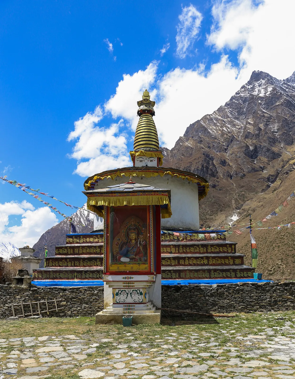
A painted chorten with a gilded spire at Chhule, the village facing Nile in the upper Tsum Valley.

Trek stop · 3,361 m

Nile

The last village of the upper Tsum Valley, a cluster of stone houses facing Chhule, a short climb from Mu Gompa.

Nearby

The Tsum Valley in Gorkha with terraced fields and forested slopes below snow peaks.

Valley or region

Tsum Valley

A restricted Buddhist side valley of the Manaslu region, with monasteries, Milarepa's cave and villages near the Tibetan border.

Trek stop · 900 m

Machha Khola

A riverside village of lodges at the mouth of a side stream, the first night's stop for most Manaslu Circuit trekkers.

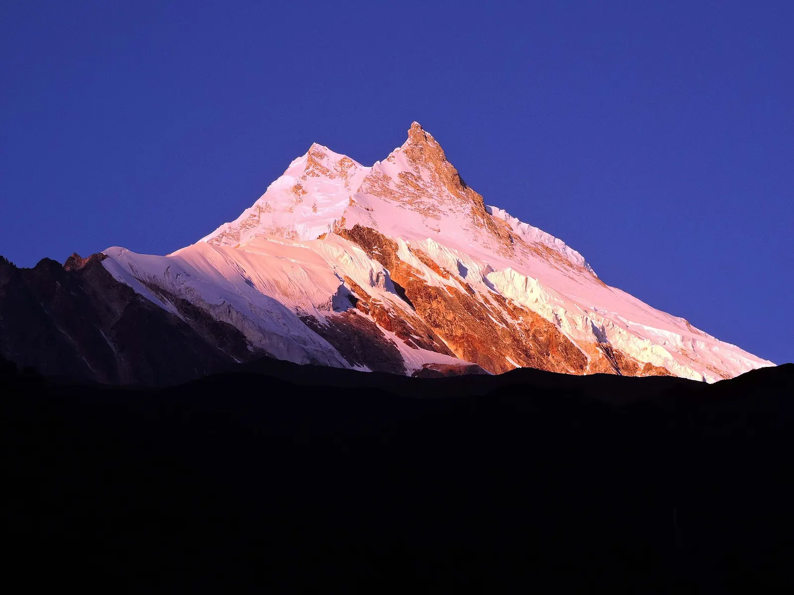
The snow-covered summit of Manaslu seen from Samagaon in the upper Budhi Gandaki valley.

Valley or region

Manaslu

A restricted trekking region around the world's eighth-highest mountain, from the Budhi Gandaki gorge to Tibetan-Buddhist villages and the Larkya La.

Editorial draft: facts are being checked against the sources below. Last checked 2026-10-06. Sources: Manaslu Trek, Wikivoyage, Department of Immigration: Trekking route and permit fee, Tsum Valley, Wikipedia