Skip to content

Pokhara & Annapurna, Tsum Valley

Tsum Valley Trek

A restricted-area trek from the Budhi Gandaki into the Buddhist Tsum Valley in northern Gorkha, through Chumling, Chhokang Paro and Nile to Mu Gompa (about 3,700 m) near the Tibetan border. Often combined with the Manaslu Circuit.

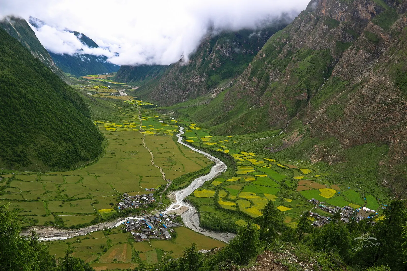
A braided river winds through green and yellow fields in the upper Tsum Valley, with two clusters of stone villages and steep cloud-capped slopes on either side.
Photo: Tsephu (CC BY 4.0)
Days
11-15
Max altitude
3,700 m
Distance
about 130 km
Difficulty
Moderate
Best months
Mar-May, Oct-Nov
Start / end
Machha Khola / Machha Khola
Sleep in
Teahouses, Homestays
Permits
Restricted area

Overview

The Tsum Valley is a side valley of the Budhi Gandaki in northern Gorkha, close to the Tibetan border, inside the Manaslu Conservation Area. It was opened to trekkers in 2008 and remains a restricted area, so visitors come in small agency groups with licensed guides.

The trek shares its first days with the Manaslu Circuit, up the Budhi Gandaki gorge to Jagat and Philim, then turns east at Lokpa into the forested gorge of the Shiar Khola. Beyond Chumling the valley opens into wide fields around Chhokang Paro, Nile and Chhule, with chortens, mani walls, Milarepa's cave and the monasteries of Rachen Gompa and Mu Gompa.

Tsum is regarded as a beyul, a sacred hidden valley, and the Tsumba people keep close cultural ties with Tibet. The trek goes no higher than about 3,700 m, which makes it gentler on altitude than the Manaslu Circuit, and it is often combined with the circuit for a longer trip.

Mu Gompa near the head of the valleyRachen Gompa nunnery and Milarepa's caveLong mani walls and chortens of Chhokang Paro, Nile and ChhuleTsumba villages with close cultural ties to TibetQuiet trails in a restricted valley

Why it is rated moderate

  • Long walking days of 5 to 7 hours on rugged gorge trails with many climbs, descents and bridges.
  • Remote restricted area with basic lodges and homestays and slow access to medical help.
  • Highest point about 3,700 m at Mu Gompa, so altitude is a factor but no high pass is crossed.

Elevation profile

About altitude

Sleeping altitude for each night. The dashed lines at 3,000 m and 4,000 m mark heights where altitude illness becomes more common. General information only, not medical advice.

Hover, tap or use the arrow keys to see each day. Shaded columns are acclimatisation days.

Show the profile as a table
Sleeping altitude by day
DayOvernightSleeping altitudeHigh point
1Machha Khola900 m-
2Jagat1,340 m-
3Lokpa2,240 m-
4Chumling2,386 m-
5Chhokang Paro3,031 m-
6Nile3,361 m-
7Nile (rest)3,361 m3,700 m
8Chhokang Paro3,031 m-
9Chumling2,386 m-
10Philim1,570 m-
11Machha Khola900 m-
12Kathmandu1,400 m-

Day-by-day itinerary

  1. Day 1, travel dayDrive Kathmandu to Machha Kholasleep 900 m

    About 8 to 10 hours by jeep via Arughat and Soti Khola; the last section is rough dirt road. Road heads change with ongoing road works.

    Teahouse in Machha KholaAbout Machha Khola

  2. Day 2Machha Khola to Jagatsleep 1,340 m6-7 habout 22 km

    Up the Budhi Gandaki gorge via Khorlabesi, Tatopani and Dobhan. Permits are checked at Jagat.

    Teahouse in JagatAbout Jagat

  3. Day 3Jagat to Lokpasleep 2,240 m6-7 habout 15 km

    Via Salleri, Sirdibas and Philim, then off the Manaslu Circuit at Ekle Bhatti and up to Lokpa, the first village of Tsum, with views back down the Budhi Gandaki.

    Teahouse or homestay in LokpaAbout Lokpa

  4. Day 4Lokpa to Chumlingsleep 2,386 m4-6 habout 9 km

    East into the forested gorge of the Shiar Khola, with a steep descent and climb, to Chumling with its old gompa and terraced fields.

    Teahouse or homestay in ChumlingAbout Chumling

  5. Day 5Chumling to Chhokang Parosleep 3,031 m5-6 habout 12 km

    Across the river and up the valley via Rainjam and Gho into the open upper valley, where Chhokang Paro's villages sit on a wide terrace with views of Ganesh Himal.

    Teahouse or homestay in Chhokang ParoAbout Chhokang Paro

  6. Day 6Chhokang Paro to Nilesleep 3,361 m4-5 habout 12 km

    Past long mani walls and chortens, Milarepa's cave (Piren Phu) and the village of Chhule to Nile, one of the highest villages in the valley.

    Teahouse or homestay in NileAbout Nile

  7. Day 7, acclimatisationDay trip to Mu Gompasleep 3,361 m4-6 habout 10 km

    Walk up the valley to Mu Gompa, the large monastery near the head of Tsum at about 3,700 m, then return to Nile. The day also helps acclimatisation.

    Teahouse or homestay in NileAbout Nilehigh point Mu Gompa, 3,700 m

  8. Day 8Nile to Chhokang Paro via Rachen Gompasleep 3,031 m5-6 habout 13 km

    Back down the valley, crossing to visit Rachen Gompa, a nunnery on the opposite bank, before returning to Chhokang Paro.

    Teahouse or homestay in Chhokang ParoAbout Chhokang Paro

  9. Day 9Chhokang Paro to Chumlingsleep 2,386 m4-5 habout 12 km

    Descend the valley to Chumling. Some itineraries take a higher route via the Gumba Lungdang nunnery, adding 1-2 days.

    Teahouse or homestay in ChumlingAbout Chumling

  10. Day 10Chumling to Philimsleep 1,570 m6-7 habout 14 km

    Back through the Shiar Khola gorge to Lokpa and down to the Budhi Gandaki and the Gurung village of Philim.

    Teahouse in PhilimAbout Philim

  11. Day 11Philim to Machha Kholasleep 900 m7-8 habout 26 km

    A long day down the gorge via Jagat, Dobhan and Tatopani; many groups split it with a night at Jagat, or meet a jeep where the track has reached.

    Teahouse in Machha KholaAbout Machha Khola

  12. Day 12, travel dayDrive Machha Khola to Kathmandusleep 1,400 m

    About 8 to 10 hours by jeep back to Kathmandu.

    Hotel in KathmanduAbout Kathmandu

Stages, times and altitudes vary by operator, weather and pace. Partner agencies confirm the exact plan.

Route map

Trail geometry from OpenStreetMap.

Mount Everest 8,848.86Kangchenjunga 8,586Dhaulagiri I 8,167Manaslu 8,163Annapurna I 8,091Machha KholaJagatLokpaChumlingChhokang ParoNileNileChhokang ParoChumlingPhilimMachha KholaKathmandu
Boundary: Government of Nepal, Survey Department (2020). Peak data: Wikidata.

Permits

  • Tsum Valley restricted area permitRestricted area

    Issued by the Department of Immigration through a registered agency; covers Chumnubri Rural Municipality wards 3, 6 and 7 (Sirdibas, Lokpa, Chumling, Chhekampar, Nile and Chhule). Its fee table lists USD 40 per week (September to November) or USD 30 per week (December to August), plus USD 7 per extra day.

  • Manaslu restricted area permitRestricted area

    Agencies usually also issue this for the approach through the Manaslu restricted area around Jagat and Philim, and it is required if you combine Tsum with the circuit; confirm what your route needs.

  • Manaslu Conservation Area entry permit (MCAP)Conservation area

    Tsum is inside the Manaslu Conservation Area. The Nepal Tourism Board's fee table lists NRs 3,000 per entry for foreign visitors.

  • TIMS cardTrekker card

    Check whether a TIMS card is currently required in addition to the restricted area permits.

Restricted area

Restricted-area permits are issued by the Department of Immigration only through a government-registered trekking agency, for trekkers accompanied by a licensed guide; the rules have long required a minimum group of two trekkers, and changes have been reported, so confirm the current rule with the Department of Immigration or a licensed agency.

Verify before travel: permit rules and fees change. Checked 2026-10-06 against Department of Immigration: Trekking route and permit fee. Guide rule: Nepal Tourism Board: TIMS card and trekking guide rule.

Nepal trekking permits explained

When to go

Best months: Mar-May, Oct-Nov

Autumn (Sep-Nov)
October and November are clear and dry, the best time for views and stable trails.
Winter (Dec-Feb)
December to February is cold in the upper valley; the trek is possible in fair weather, but some lodges close and snow can fall around Mu Gompa.
Spring (Mar-May)
March to May is mild, with rhododendrons in the lower forest and fields being planted in the upper valley.
Monsoon (Jun-Aug)
June to August brings rain, leeches and landslide risk in the Budhi Gandaki and Shiar Khola gorges.

Getting there and back

Getting to Machha Khola, by mode

Nearest hub: Kathmandu. Times are typical ranges, not schedules, and vary with roadworks, weather and the season.

  • By busfrom KathmanduLocal buses

    Public buses run from Kathmandu as far as Arughat or Soti Khola; the last rough stretch up the valley is normally a shared jeep, so a through bus band would be misleading.

    When to set off: morning departures from Kathmandu, by about 07:00

    Manaslu Trek, Wikivoyage

  • By car or jeepfrom Kathmanduabout 8-10 h

    A hired jeep is the usual way in: sealed road as far as Dhading Besi or Gorkha, then an unpaved hill road through Arughat to Soti Khola, and on up the valley to Machha Khola when the track allows.

    Road: Sealed to Dhading Besi or Gorkha, then a largely unpaved hill road through Arughat; a jeep or 4WD is normally needed and the upper sections are monsoon-affected.

    When to set off: leave Kathmandu by about 06:00 to reach the roadhead in daylight

    Manaslu Trek, Wikivoyage

  • By motorbikefrom Kathmanduabout 9-12 hExperienced riders only

    Riders do reach the Manaslu roadhead, but the stretch beyond Arughat is rough, dusty and exposed, with river crossings and loose surfaces, so it suits experienced off-road riders only.

    Road: Highway to Dhading Besi, then an unpaved hill road with loose gravel, steep pitches and stream crossings beyond Arughat.

    When to set off: start early; the unpaved section beyond Arughat is slow going

    Manaslu Trek, Wikivoyage

  • On footfrom Soti Kholaabout 6-7 h6-7 h from Soti Khola, up and down beside the river with a net gain of only about 150-200 m

    Most trekkers who drive straight to Machha Khola skip this stage; walked, it is a gentle but long first day.

    Manaslu Trek, Wikivoyage

Where people go next

  • Jagat (Gorkha)on foot, about 6-7 hThrough the narrowing gorge via Tatopani, Dobhan and Yaru, gaining roughly 400-500 m.
  • Lokpaon footAbout 1.5 walking days via Jagat and Philim for the Tsum Valley branch.
  • Soti Kholaon foot, about 5-7 hDownstream stage back to the roadhead, or a shared jeep when the track allows.

Seasonal risks

Typical seasonal exposure along the route, merged from the stops that have a place page. Seasonal patterns only, never conditions today.

  • Altitudehigh in a typical yearAll year

    At roughly 3,361 m, thin air affects most people. General information, not medical advice: gain height slowly, build in acclimatisation days, learn the symptoms of altitude sickness (headache, nausea, breathlessness, broken sleep) and go down if they get worse. See a doctor before travelling and carry insurance that covers helicopter evacuation.

    Recorded for Tsum Valley, Chhokang Paro, Nile. Tsum Valley, Wikipedia

  • Landslideshigh in a typical yearJun-Sep

    The approach up the Budhi Gandaki and the forested lower Tsum trail are landslide-prone in the June to September monsoon; the upper valley is drier but the way in is the problem.

    Recorded for Tsum Valley, Machha Khola, Jagat (Gorkha), Lokpa and 5 more. Manaslu Trek, Wikivoyage

  • River crossingshigh in a typical yearJun-Sep

    The route crosses the Budhi Gandaki repeatedly on suspension bridges, and near Yaru a cantilever walkway carries the trail along the gorge wall. These are the most exposed sections when the river runs high in the monsoon.

    Recorded for Tsum Valley, Machha Khola, Jagat (Gorkha), Lokpa and 2 more. Manaslu Trek, Wikivoyage

  • Road blockageshigh in a typical yearJun-Sep

    The largely unpaved road beyond Arughat is prone to landslide blockages and washouts during the June to September monsoon, when most of Nepal's annual rain falls.

    Recorded for Tsum Valley, Machha Khola, Jagat (Gorkha), Kathmandu. Climate of Nepal, Wikipedia

  • Snowhigh in a typical yearNov-Mar

    Snow is common in the upper Tsum valley from late autumn to spring; many lodges close and some residents move down the valley.

    Recorded for Tsum Valley, Chhokang Paro, Nile. Manaslu Trek, Wikivoyage

  • Coldhigh in a typical yearNov-Feb

    Midwinter is very cold in the upper valley above about 3,000 m.

    Recorded for Tsum Valley, Lokpa, Chumling, Chhokang Paro and 2 more. Manaslu Trek, Wikivoyage

  • Othermoderate in a typical yearJun-Aug, Dec-Apr

    Leeches are common on the forested lower trail through the monsoon, which is one reason most trekkers avoid these months.

    Recorded for Tsum Valley, Machha Khola, Jagat (Gorkha), Lokpa and 3 more. Manaslu Trek, Wikivoyage

  • Floodingmoderate in a typical yearJun-Sep

    Riverside settlements and trail sections beside the Budhi Gandaki sit close to the water, and monsoon rain raises the river and its side streams quickly.

    Recorded for Machha Khola, Jagat (Gorkha), Philim, Kathmandu. Climate of Nepal, Wikipedia

  • Heatmoderate in a typical yearApr-May

    At about 900 m the gorge is hot and close in April and May, before the monsoon breaks.

    Recorded for Machha Khola. Climate of Nepal, Wikipedia
Check current conditions before you travel

Nothing here describes the Tsum Valley Trek today. Trail, road, pass and flight conditions change with the weather and with roadworks. Check the Department of Hydrology and Meteorology, the Nepal Disaster Risk Reduction Portal and the local authority or your licensed operator before and during the trek.

Weather on the route

Forecasts for start (Machha Khola, 900 m), highest overnight (Nile, 3,361 m), end (Kathmandu, 1,400 m). Mountain weather changes fast; check again on the day.

Weather in Machha Khola (start)

Forecast for 900 m. Conditions change fast in the mountains.

Weather data: MET Norway, licensed CC BY 4.0. A forecast, not a guarantee.

Weather in Nile (highest overnight)

Forecast for 3,361 m. Conditions change fast in the mountains.

Weather data: MET Norway, licensed CC BY 4.0. A forecast, not a guarantee.

Weather in Kathmandu (end)

Forecast for 1,400 m. Conditions change fast in the mountains.

Weather data: MET Norway, licensed CC BY 4.0. A forecast, not a guarantee.

Safety

Above about 3,000 m, a widely used guideline is to increase your sleeping altitude by no more than about 500 m a day and to take an extra night at the same altitude every 3 to 4 days (CDC Yellow Book; Wilderness Medical Society). This is general information, not medical advice.
Know the signs of acute mountain sickness: headache with nausea, loss of appetite, unusual tiredness, dizziness or poor sleep. Do not go higher with symptoms, and go down if they get worse. Confusion, stumbling, or breathlessness at rest are emergencies: descend at once and get help.
See a doctor before you travel, especially about any medicine for altitude, and buy travel insurance that explicitly covers trekking and helicopter evacuation up to the highest altitude of this trek.
The Budhi Gandaki and Shiar Khola gorges are prone to landslides and rockfall, especially in the monsoon. Cross slide areas quickly and follow your guide's advice.
Tsum is remote, with limited medical help and slow evacuation; make sure your insurance covers helicopter rescue and carry a well-stocked first-aid kit.
On suspension bridges and narrow trails, let mule trains pass and stand on the uphill side.

What to pack

  • Broken-in trekking boots
  • Sleeping bag rated for nights below freezing
  • Warm jacket and hat for the upper valley
  • Trekking poles for steep gorge sections
  • Water purification tablets or a filter
  • Cash in rupees for the whole trek; no ATMs
  • Modest clothing for monastery visits
  • Passport copies and photos for permits
Full trekking gear list

Side trips and alternatives

  • Manaslu Circuit

    Rejoin the Budhi Gandaki at Lokpa or Philim and continue north via Deng and Namrung to Samagaun and the Larkya La.

  • Mu Gompa

    The monastery near the head of the valley, at about 3,700 m.

  • Rachen Gompa

    A nunnery across the river from Chhokang Paro.

  • Gumba Lungdang

    A nunnery on a high shoulder above the lower valley, reached on a longer exit route; some groups continue to a viewpoint below Ganesh Himal.

Tsum Valley questions

How many days is the Tsum Valley trek?

About 11 to 15 days from Kathmandu. Combined with the Manaslu Circuit it takes about 18 to 22 days.

Do I need a special permit for Tsum?

Yes. Tsum is a restricted area: the Department of Immigration issues the Tsum Valley permit only through a registered agency, for trekkers with a licensed guide. You also need the MCAP entry permit, and usually the Manaslu restricted permit for the approach.

How high does the Tsum Valley trek go?

The highest point is Mu Gompa, at about 3,700 m. The highest night on this itinerary is Nile, at about 3,360 m.

Can I combine Tsum with the Manaslu Circuit?

Yes. Most combined itineraries visit Tsum first, return to the Budhi Gandaki at Lokpa or Philim and then continue north to Samagaun and the Larkya La.

When is the best time to visit Tsum?

October and November, then March to May. The monsoon brings rain and landslides in the gorges.

Similar treks

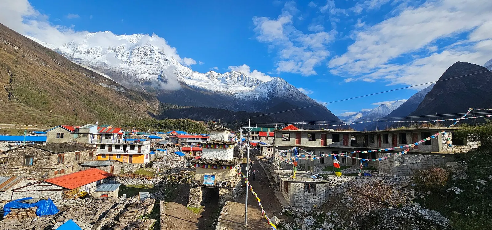
Stone houses and lodges of Samagaun with blue and red roofs, below snow-capped peaks of the Manaslu range.

A restricted-area teahouse trek around Manaslu (8,163 m), up the Budhi Gandaki gorge through Gurung and Nubri villages, over the Larkya La (about 5,106 m) and down to Dharapani on the Annapurna Circuit.

Days
12 days
Maximum altitude
5,106 m
Difficulty
Strenuous

A restricted-area trek from Koto on the Annapurna Circuit into the high Tibetan Buddhist villages of Phu and Nar, crossing the Kang La (about 5,320 m) to Ngawal and Manang.

Days
12 days
Maximum altitude
5,320 m
Difficulty
Strenuous
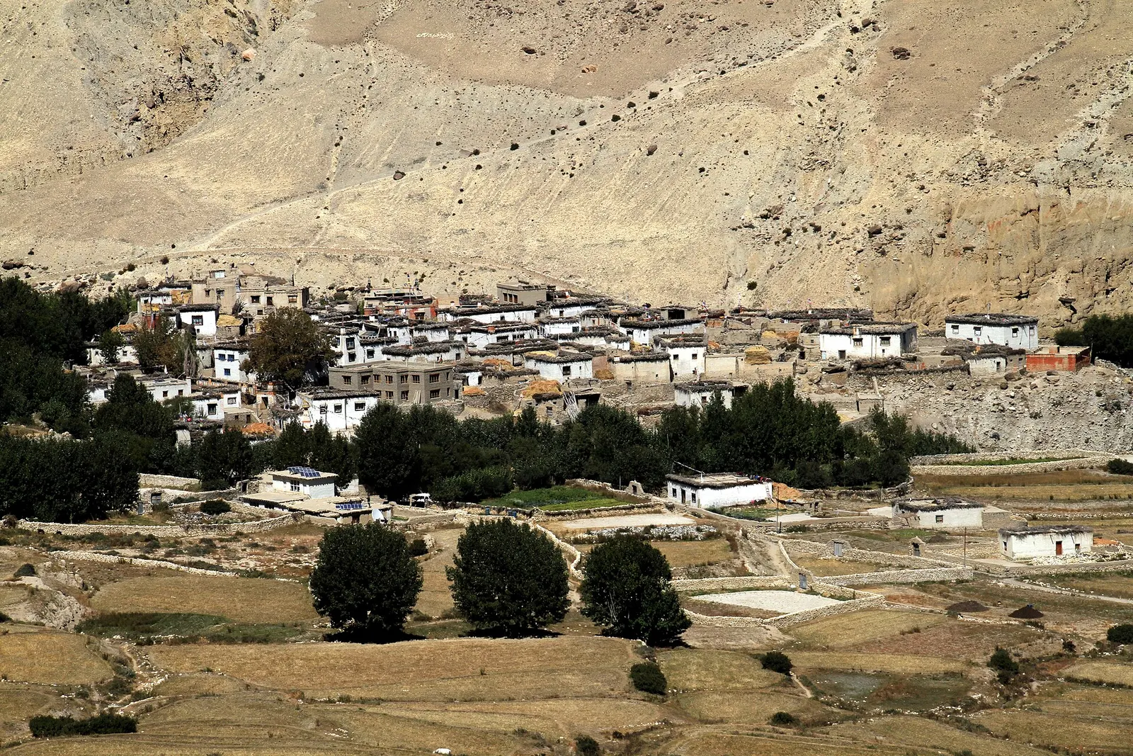
Whitewashed flat-roofed houses of Ghami village in Upper Mustang, with trees and fields below an eroded tan cliff.

A restricted-area trek north from Kagbeni through the eroded canyons of the former Kingdom of Lo to the walled town of Lo Manthang, returning via Lo Gekar and Dhakmar.

Days
12 days
Maximum altitude
4,325 m
Difficulty
Moderate

Tsum Valley · 12 days