Skip to content

Kathmandu Valley, Helambu

Helambu Trek

A short trek that starts on the edge of Kathmandu at Sundarijal and follows forested ridges to Tharepati (about 3,650 m), then visits the Hyolmo villages of Melamchi Gaon, Tarkeghyang and Sermathang before a drive back.

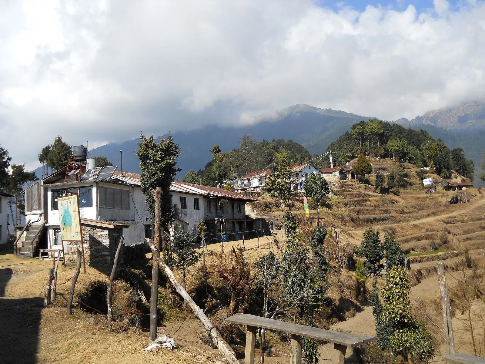
Houses and lodges of Kutumsang on a terraced ridge with pine trees and forested hills behind.
Photo: AjayKumarShrestha (CC BY-SA 3.0)
Days
5-8
Max altitude
3,650 m
Distance
about 60 km
Difficulty
Moderate
Best months
Mar-Apr, Oct-Dec
Start / end
Sundarijal / Sermathang (road to Melamchi Bazaar)
Sleep in
Teahouses, Homestays
Permits
3 required

Overview

Helambu is a region of Hyolmo villages, gompas and apple orchards north-east of Kathmandu, between the Melamchi valley and the high ridge that leads to Gosaikunda. The classic trek begins at Sundarijal on the rim of the Kathmandu Valley, so you can walk out of the city without a long drive.

The first days follow ridges through Shivapuri Nagarjun National Park and pine and rhododendron forest to Chisapani, Kutumsang and the high point at Tharepati, with views of the Langtang, Jugal and Dorje Lakpa ranges. The trail then drops into the Hyolmo heartland, where village gompas, stone houses and terraced fields set the tone.

The trek is relatively low, which makes it a good option in winter or for a first trek in Nepal, and dirt roads now reach the upper villages, so it can be shortened. Strong walkers can join it to Gosaikunda over the Lauribina La.

Walk out of the Kathmandu Valley from SundarijalRidge views of the Langtang, Jugal and Dorje Lakpa rangesHyolmo villages and gompas of Melamchi Gaon and TarkeghyangRhododendron forest around TharepatiGood winter option at mostly moderate altitude

Why it is rated moderate

  • Walking days of 3 to 7 hours with frequent climbs and descents along the ridges.
  • One climb of about 1,200 m to Tharepati (about 3,650 m), followed by a steep 1,000 m descent.
  • Mostly below 3,000 m, so altitude is less of a factor than on the higher Langtang treks.

Elevation profile

About altitude

Sleeping altitude for each night. The dashed lines at 3,000 m and 4,000 m mark heights where altitude illness becomes more common. General information only, not medical advice.

Hover, tap or use the arrow keys to see each day. Shaded columns are acclimatisation days.

Show the profile as a table
Sleeping altitude by day
DayOvernightSleeping altitudeHigh point
1Chisapani2,215 m-
2Kutumsang2,470 m-
3Tharepati3,650 m-
4Melamchi Gaon2,590 m-
5Tarkeghyang2,600 m-
6Sermathang2,625 m-
7Kathmandu1,400 m-

Day-by-day itinerary

  1. Day 1Sundarijal to Chisapanisleep 2,215 m4-5 habout 12 km

    Drive 30-60 minutes from central Kathmandu to Sundarijal, then climb stone steps beside the old water pipeline and through Shivapuri Nagarjun National Park to the ridge at Chisapani. Views of the Langtang and Jugal ranges on clear mornings.

    Teahouse in ChisapaniAbout Chisapani

  2. Day 2Chisapani to Kutumsangsleep 2,470 m6-7 habout 16 km

    Along the ridge via Pati Bhanjyang, Chipling and Gul Bhanjyang, with several climbs and descents through farmland and forest.

    Teahouse in KutumsangAbout Kutumsang

  3. Day 3Kutumsang to Tharepatisleep 3,650 m5-6 habout 10 km

    Into the forest of Langtang National Park via Mangengoth, climbing about 1,200 m to the open ridge at Tharepati, where the trail from Gosaikunda joins.

    Teahouse in TharepatiAbout Tharepati

  4. Day 4Tharepati to Melamchi Gaonsleep 2,590 m3-4 habout 6 km

    A steep descent of about 1,000 m through forest to the Hyolmo village of Melamchi Gaon and its gompa.

    Teahouse or homestay in Melamchi GaonAbout Melamchi Gaon

  5. Day 5Melamchi Gaon to Tarkeghyangsleep 2,600 m5-6 habout 9 km

    Down to the Melamchi Khola and up the other side of the valley to Tarkeghyang, the largest Hyolmo village, with its old gompa and stone lanes.

    Teahouse or homestay in TarkeghyangAbout Tarkeghyang

  6. Day 6Tarkeghyang to Sermathangsleep 2,625 m3-4 habout 6 km

    An easier walk contouring through forest, orchards and farmland to Sermathang.

    Teahouse or homestay in SermathangAbout Sermathang

  7. Day 7, travel daySermathang to Kathmandu by roadsleep 1,400 m

    By jeep or bus down to Melamchi Bazaar and on to Kathmandu, roughly 5 to 7 hours. You can instead walk down to Melamchi Bazaar in 4-5 hours.

    Hotel in KathmanduAbout Kathmandu

Stages, times and altitudes vary by operator, weather and pace. Partner agencies confirm the exact plan.

Route map

Trail geometry from OpenStreetMap.

Mount Everest 8,848.86Kangchenjunga 8,586Dhaulagiri I 8,167Manaslu 8,163Annapurna I 8,091ChisapaniKutumsangTharepatiMelamchi GaonTarkeghyangSermathangKathmandu
Boundary: Government of Nepal, Survey Department (2020). Peak data: Wikidata.

Permits

  • Shivapuri Nagarjun National Park entry permitNational park

    For the Sundarijal to Chisapani section; paid at the park gate or the Tourist Service Centre in Kathmandu. The Nepal Tourism Board's fee table lists NRs 1,000 per entry for foreign visitors.

  • Langtang National Park entry permitNational park

    For the higher trail, including Tharepati. The Nepal Tourism Board's fee table lists NRs 3,000 per entry for foreign visitors.

  • TIMS cardTrekker card

    Issued through a registered trekking agency under the 2023 rule; check the current requirement.

Verify before travel: permit rules and fees change. Checked 2026-10-06 against Nepal Tourism Board: Park entry fees. Guide rule: Nepal Tourism Board: TIMS card and trekking guide rule.

Nepal trekking permits explained

When to go

Best months: Mar-Apr, Oct-Dec

Autumn (Sep-Nov)
October and November are the best months, with dry trails and mountain views from the ridges.
Winter (Dec-Feb)
December to February is cold but often clear; snow can cover the ridge around Tharepati, while the lower villages stay walkable.
Spring (Mar-May)
March and April bring rhododendrons in flower; haze and afternoon showers increase by May.
Monsoon (Jun-Aug)
June to August is wet, with leeches in the forest, slippery trails and road damage around Melamchi.

Getting there and back

Getting to Chisapani, by mode

Nearest hub: Kathmandu. Times are typical ranges, not schedules, and vary with roadworks, weather and the season.

  • By busfrom Kathmanduabout 0.5-1 hLocal buses

    Buses run to Sundarijal from Boudhanath; the Helambu trek starts at the Sundarijal trailhead at about 1,390 m.

    When to set off: Leave Kathmandu early so the first walking stage is done before the afternoon cloud.

    Helambu (Wikipedia)

  • By car or jeepfrom Kathmanduabout 0.5-1 h

    A taxi or car reaches the Sundarijal roadhead on the north-east rim of the Kathmandu valley in well under an hour.

    Road: Short sealed city and valley road to the Sundarijal roadhead.

    When to set off: Leave Kathmandu by about 07:00 to start walking in the morning.

    Helambu (Wikipedia)

  • On footfrom Kathmanduabout 4-5 hAbout 4-5 h and roughly 12 km from Sundarijal, climbing about 800 m

    On foot from the Sundarijal roadhead through Shivapuri Nagarjun National Park, via Mulkharka and Burlang Bhanjyang.

    When to set off: Start walking from Sundarijal in the morning: the climb to the ridge is about 800 m with little shade near the top.

    Helambu (Wikipedia)

Where people go next

  • Kutumsangon foot, about 6-7 hNext ridge stage, via Gul Bhanjyang.
  • Kathmanduby car or jeep, about 0.5-1 hBack to the city from the Sundarijal roadhead.
  • Shivapuri Nagarjun National Parkon footThe trail crosses Shivapuri Nagarjun National Park.
  • Helambuon footChisapani is the first stop of the Helambu trek.

Seasonal risks

Typical seasonal exposure along the route, merged from the stops that have a place page. Seasonal patterns only, never conditions today.

  • Snowhigh in a typical yearDec-Apr

    The ridge around Tharepati takes snow in late winter and early spring, when the traverse and the Lauribina La link can be slow or impractical.

    Recorded for Helambu, Chisapani, Kutumsang, Tharepati and 3 more. Helambu (Wikipedia)

  • Coldhigh in a typical yearDec-Feb

    December to February brings hard frost and deep cold at this height, with short days and lightly heated lodges; a four-season sleeping bag and down layers are normal kit.

    Recorded for Helambu, Chisapani, Kutumsang, Tharepati and 4 more. Langtang National Park (Wikivoyage)

  • Landslidesmoderate in a typical yearJun-Sep

    Steep forested hillsides on these ridges shed small slides and washed-out trail sections during monsoon rain; rocky trails stay slippery after rain or frost.

    Recorded for Helambu, Chisapani, Kutumsang, Tharepati and 4 more. Langtang National Park (Wikivoyage)

  • Floodingmoderate in a typical yearJun-Sep

    The Melamchi river carries a documented monsoon flash-flood and debris-flow risk: in June and July 2021 long monsoon rain loosened material upstream, the river was dammed and the breach swept away homes, roads and bridges in the valley.

    Recorded for Helambu, Melamchi Gaon, Tarkeghyang, Sermathang and 1 more. 2021 Melamchi flood (Wikipedia)

  • Othermoderate in a typical yearJun-Sep, Dec-Apr

    From June to August the forest trails are slippery after rain, leeches are common and the mountains are usually hidden by cloud.

    Recorded for Helambu, Chisapani, Kutumsang, Tharepati and 4 more. Langtang National Park (Wikivoyage)

  • Altitudemoderate in a typical yearAll year

    General information, not medical advice: above about 3,000 m altitude illness becomes a real risk. Gain sleeping height slowly, learn the symptoms of headache with nausea, breathlessness or unsteady walking, and go down if they get worse. See a doctor before travelling and carry insurance that covers helicopter evacuation. The Helambu ridge tops out at about 3,650 m at Tharepati, and the Lauribina La link to Gosaikunda is higher again.

    Recorded for Helambu, Tharepati. Altitude sickness (Wikivoyage)

  • Road blockagesmoderate in a typical yearJun-Sep

    The jeep roads up from Melamchi Bazaar to the upper villages are earth tracks that soften and slide in monsoon rain, so the drive can be slow or interrupted.

    Recorded for Helambu, Tarkeghyang, Sermathang, Kathmandu. Landslide damming (Nepal) (Wikipedia)
Check current conditions before you travel

Nothing here describes the Helambu Trek today. Trail, road, pass and flight conditions change with the weather and with roadworks. Check the Department of Hydrology and Meteorology, the Nepal Disaster Risk Reduction Portal and the local authority or your licensed operator before and during the trek.

Weather on the route

Forecasts for start (Chisapani, 2,215 m), highest overnight (Tharepati, 3,650 m), end (Kathmandu, 1,400 m). Mountain weather changes fast; check again on the day.

Weather in Chisapani (start)

Forecast for 2,215 m. Conditions change fast in the mountains.

Weather data: MET Norway, licensed CC BY 4.0. A forecast, not a guarantee.

Weather in Tharepati (highest overnight)

Forecast for 3,650 m. Conditions change fast in the mountains.

Weather data: MET Norway, licensed CC BY 4.0. A forecast, not a guarantee.

Weather in Kathmandu (end)

Forecast for 1,400 m. Conditions change fast in the mountains.

Weather data: MET Norway, licensed CC BY 4.0. A forecast, not a guarantee.

Safety

Tharepati is at about 3,650 m. Some people feel mild altitude symptoms there; know the signs (headache, nausea, unusual tiredness), do not go higher with them, and go down if they get worse. This is general information, not medical advice.
Cloud and snow can sit on the ridge around Tharepati; do not attempt the high route towards Ghopte and Gosaikunda in poor visibility or without a guide.
Trails are steep and slippery after rain, and leeches are common in the monsoon. Trekking poles help on the long descents.
Roads in the Melamchi valley were badly damaged by floods in 2021 and landslides recur in the monsoon; check road conditions for the drive out.

What to pack

  • Comfortable trekking boots with good grip
  • Trekking poles for the steep descents
  • Warm jacket and hat for the night at Tharepati
  • Sleeping bag for cold nights
  • Rain jacket
  • Water purification tablets or a filter
  • Cash in rupees
Full trekking gear list

Side trips and alternatives

  • Gosaikunda over the Lauribina La

    From Tharepati head north-west via Ghopte and the Lauribina La (about 4,610 m) to the sacred lakes, then out to Dhunche; adds 3-4 days and needs good weather.

  • Ama Yangri viewpoint

    A steep climb above Tarkeghyang to a hilltop with views of the Jugal and Langtang ranges.

  • Shivapuri hike

    A day hike to Shivapuri peak from the Kathmandu side of the park.

Helambu questions

How long is the Helambu trek?

About 5 to 7 days from Kathmandu. Dirt roads to Tarkeghyang and Sermathang let you shorten it, and you can add 3 to 4 days to cross to Gosaikunda.

How high does the Helambu trek go?

The highest point is Tharepati, at about 3,650 m. Most nights are between about 2,200 m and 2,600 m.

Can I trek Helambu in winter?

Yes, it is one of the better winter treks, though snow can lie around Tharepati. The lower villages are usually clear.

Do I need a guide for Helambu?

The Nepal Tourism Board lists the Helambu Trek among routes that require a licensed guide and an agency-issued TIMS card under the 2023 rule. Confirm the current rule before you go.

Who are the Hyolmo people?

The Hyolmo (Yolmo) are the Buddhist people of Helambu, who speak the Yolmo language; their villages are built around gompas called ghyang.

Similar treks

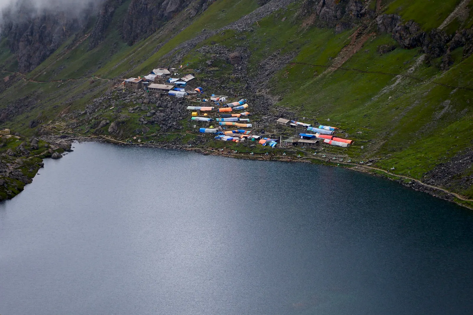
The dark water of Gosaikunda lake with a cluster of lodges with coloured roofs on the green slope above its shore.

The Langtang Valley to Kyanjin Gompa combined with the climb to the sacred Gosaikunda lakes (about 4,380 m) via Thulo Syabru and Sing Gompa, finishing at Dhunche. Check road access after the August 2026 floods.

Days
11 days
Maximum altitude
4,984 m
Difficulty
Strenuous
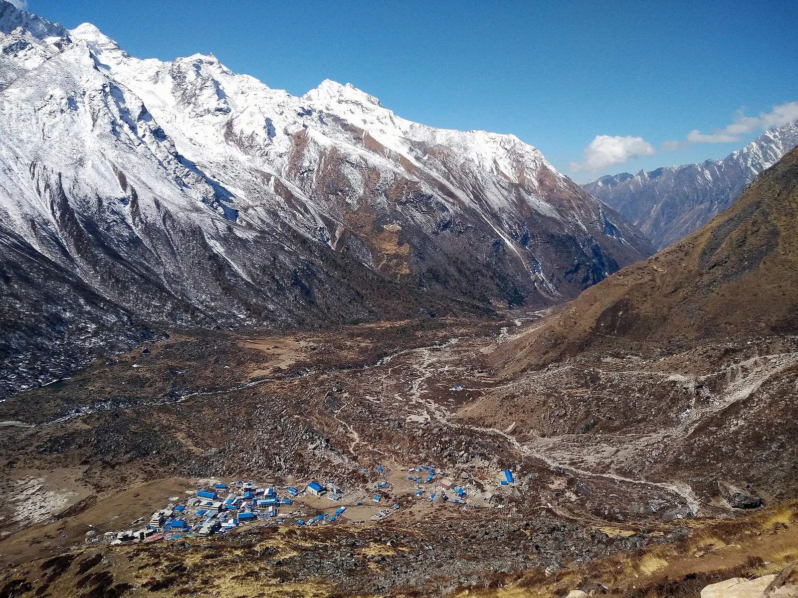
Kyanjin Gompa's blue-roofed buildings on the wide valley floor, seen from Kyanjin Ri beneath snowy Langtang peaks

A road-accessed teahouse trek from Syabrubesi up the Langtang Khola to Kyanjin Gompa (about 3,870 m), with an optional climb to Tserko Ri for close views of Langtang Lirung. Check road access after the August 2026 floods.

Days
8 days
Maximum altitude
4,984 m
Difficulty
Moderate
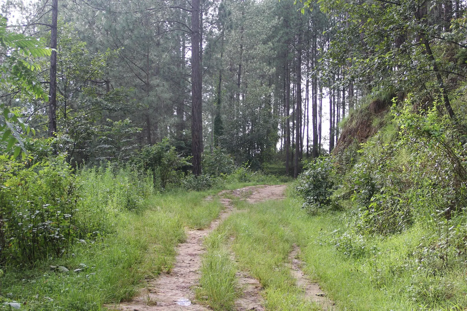
A grassy dirt track leads through tall pine forest on the way to Balthali village.

A short, low walk south-east of Kathmandu from Dhulikhel to the Buddhist pilgrimage site of Namo Buddha, on to the farming village of Balthali, and down to the old Newar town of Panauti. No permit needed.

Days
3 days
Maximum altitude
1,750 m
Difficulty
Easy
Editorial draft: altitudes, permits and rules are being checked against the sources below. Last checked 2026-10-06. Sources: Helambu, Wikipedia, Sermathang, Wikipedia, Nepal Tourism Board: Park entry fees, Nepal Tourism Board: TIMS card and trekking guide rule

Helambu · 7 days