Skip to content

Langtangगोसाइँकुण्ड

Gosaikunda

A sacred alpine lake at about 4,380 m in Langtang National Park, a Hindu and Buddhist pilgrimage site and a high point between Langtang and Helambu.

This is the sacred lake in Langtang National Park, Rasuwa; Gosaikunda Rural Municipality is the wider local government area.

Plan a trip here
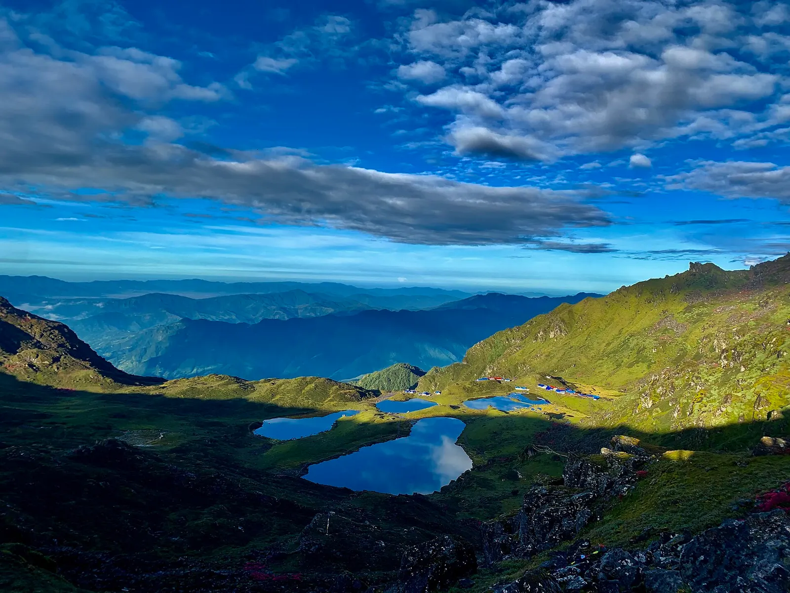
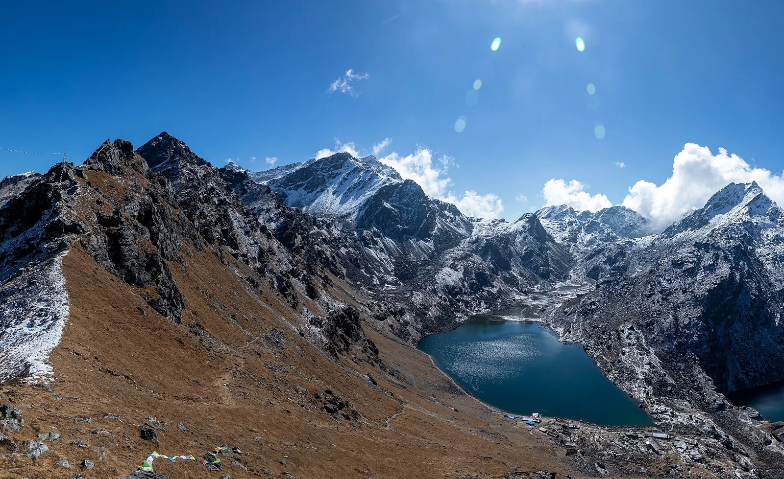
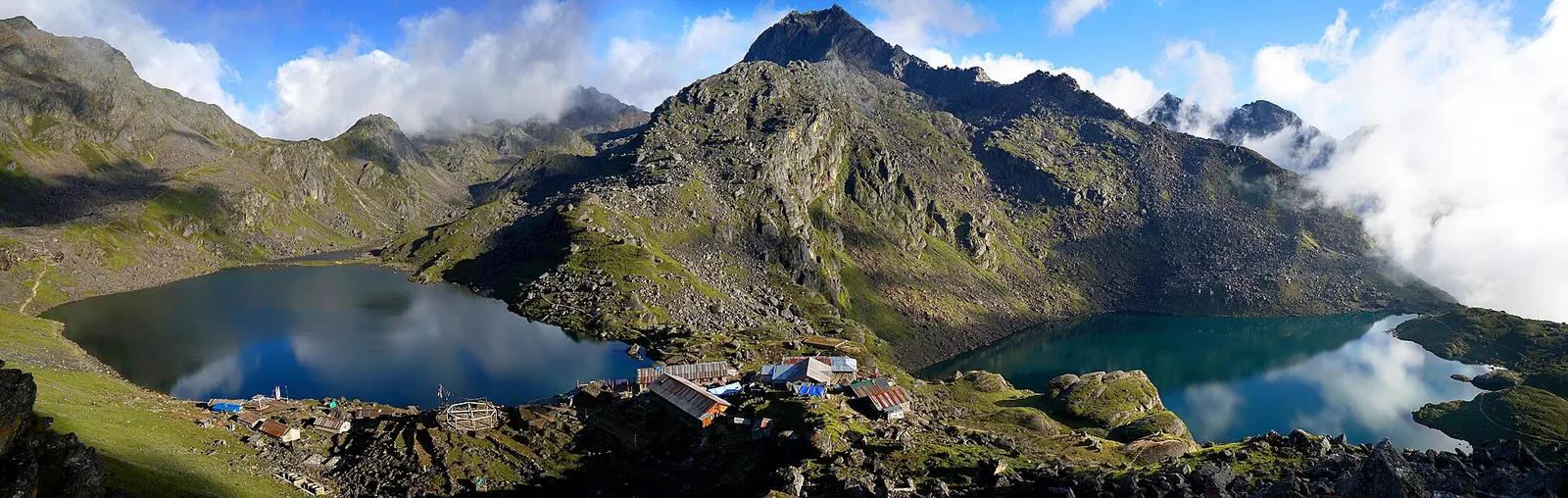
The blue Gosaikunda lake in a rocky alpine basin.
Photo: Sangyam adventurer (CC BY-SA 4.0)
Altitude
4,380 m*
Best months
Apr-May, Oct-Nov
Type
Lake
District
Rasuwa, Bagmati
Permit
Permit required

Higher seasonal exposure: altitude (All year), snow (Nov-May), cold (Nov-Mar), landslides (Jun-Sep), road blockages (Jun-Sep).

Why go

Gosaikunda (also spelled Gosainkunda) is a glacial lake at about 4,380 m in the Rasuwa part of Langtang National Park, the best known of a cluster of high lakes around the Lauribina La. The main lake covers about 14 hectares, and together with its neighbours, including Bhairab Kunda and Saraswati Kunda, the lake system is a Ramsar wetland of international importance, listed in 2007. The lake is usually frozen for much of the winter.

For trekkers it is the high point of the route between the Langtang Valley and Helambu. From Dhunche the climb goes through forest to Chandanbari (Sing Gompa) and the ridge at Lauribina, where on clear days the Langtang, Ganesh Himal and Annapurna ranges line up to the north-west, then on to the lake. The trail continues over the Lauribina La (about 4,610 m) and down into Helambu. Within the Langtang hub, Gosaikunda links the Langtang Valley and Helambu pages.

History and culture

Hindus revere Gosaikunda as a lake created by Shiva. According to legend, after swallowing the poison that emerged from the churning of the ocean, Shiva struck the mountain with his trident to release cool water to ease his burning throat, forming the lake. A rock in the lake is seen by some as Shiva's form. Another belief holds that the water of the Kumbheshwar temple pond in Patan is connected to Gosaikunda, so those who cannot make the journey bathe there instead.

Thousands of pilgrims walk to the lake for Janai Purnima in July or August to bathe and change their sacred thread; Buddhists also honour the site. Among Newars the lake is known as Silu, the subject of a well-known folk song. Trekkers should avoid the peak pilgrimage days if they want quiet trails and lodge space, or join respectfully if they want to see the festival.

Things to do in Gosaikunda

  • Trek from Dhunche

    Climb to the lake in about 2-3 days via Chandanbari and Lauribina, allowing time to acclimatise.

  • Walk around the lakes

    Follow paths around Gosaikunda and to nearby lakes such as Bhairab Kunda, best in the clear morning.

  • Cross to Helambu

    Continue over the Lauribina La (about 4,610 m) to Phedi and Ghopte, then through Helambu towards Sundarijal or Melamchi.

Weather and the best time to visit Gosaikunda

Weather in Gosaikunda

Forecast for 4,380 m. Conditions change fast in the mountains.

Weather data: MET Norway, licensed CC BY 4.0. A forecast, not a guarantee.

Best time to visit

Apr-May, Oct-Nov

  1. Jan
  2. Feb
  3. Mar
  4. Good month: Apr
  5. Good month: May
  6. Jun
  7. Jul
  8. Aug
  9. Sep
  10. Good month: Oct
  11. Good month: Nov
  12. Dec
Autumn (Sep-Nov)
October and November give the most reliable clear weather for the lake and pass.
Winter (Dec-Feb)
The lake freezes and snow can make the Lauribina La dangerous or impassable; many lodges close.
Spring (Mar-May)
April and May are good; early spring may still have snow near the pass.
Monsoon (Jun-Aug)
Rain and cloud, but pilgrims come for Janai Purnima in July or August; trails are slippery and leeches common lower down.

Where to stay

TeahousesLodges

A few simple lodges stand by the lake; they fill up during Janai Purnima and may close in deep winter.

No partner stays are listed here yet. List a property.

Getting there

Gosaikunda is reached on foot, most directly from Dhunche in Rasuwa, or from the Langtang Valley via Thulo Syabru, or from Helambu over the Lauribina La.

Nearest hub: Dhunche

  • roadKathmandu to Dhunche, normally about 6-8 hours by bus or jeep; road damaged by the August 2026 floods, check current access.
  • trekDhunche to Gosaikunda in about 2-3 days, climbing about 2,400 m.
  • trekFrom the Langtang Valley via Thulo Syabru and Sing Gompa in about 2 days.
  • trekFrom Helambu via Tharepati, Ghopte and the Lauribina La in about 2-3 days.

Getting to Gosaikunda, by mode

Nearest hub: Dhunche. Times are typical ranges, not schedules, and vary with roadworks, weather and the season.

  • By busfrom Kathmanduabout 6-9 hLocal buses

    Buses reach Dhunche, the nearest roadhead; the lakes are 2 to 3 days further on foot via Sing Gompa and Lauribina.

    When to set off: Rasuwa buses leave Macha Pokhari bus park in the morning.

    Langtang Valley Trek (Wikivoyage)

  • By car or jeepfrom Kathmanduabout 5-8 h

    A jeep can go no further than Dhunche; everything above is on foot.

    Road: Sealed but steep and broken hill road to Dhunche, slide-prone in the monsoon; no road to the lakes.

    When to set off: Leave Kathmandu by about 06:00 to start walking from Dhunche the same afternoon.

    Langtang Valley Trek (Wikivoyage)

  • On footfrom Sing Gompa (Chandanbari)about 3-6 hAbout 3-4 h from Lauribina to the lakes, 400-500 m of gain on rocky ground

    On foot only. Two to three days from Dhunche via Sing Gompa and Lauribina, about two days from the Langtang valley via Thulo Syabru, or two to three days from Helambu over the Lauribina La.

    When to set off: Cross the Lauribina La early in the day, before cloud and wind build.

    Langtang National Park (Wikivoyage)

Where people go next

  • Sing Gompa (Chandanbari)on footThe main approach and the nearest lodges below the lakes.
  • Tharepation footOver the Lauribina La into Helambu, usually two days with a night at Ghopte.
  • Dhuncheon footLong descent of about 2,400 m to the road.
  • Langtang Valleyon footDown via Thulo Syabru to the Langtang valley trail.
Mount Everest 8,848.86Kangchenjunga 8,586Dhaulagiri I 8,167Manaslu 8,163Annapurna I 8,091GosaikundaKathmandu
Boundary: Government of Nepal, Survey Department (2020). Peak data: Wikidata.

Permits and fees

Permit required

Gosaikunda is inside Langtang National Park; a park entry permit is required. Check whether a TIMS card is currently required. Since April 2023 foreign trekkers in national parks and conservation areas are generally required to go with a licensed guide; check the current rule.

  • Langtang National Park entry permit: Checked at Dhunche and along the trail.

Verify before travel: permit rules and fees change. Checked 2026-10-06 against Langtang National Park (Wikivoyage).

On the trail

On the Gosaikunda trek, Langtang, Gosaikunda and Helambu trek.

Previous stop:
Lauribina
Next stop:
Lauribina La, then Phedi and Ghopte
A typical day:
About 3-4 hours from Lauribina with roughly 400-500 m of height gain on a rocky trail; the following day crosses the Lauribina La (about 4,610 m) in 6-8 hours.

Risks and conditions

Seasonal risks around Gosaikunda

What this place is typically exposed to, and when. These are seasonal patterns, not a report on conditions now.

  • Altitudehigh in a typical yearAll year

    General information, not medical advice: this is high ground where altitude illness is a real risk. Gain height slowly, build in an acclimatisation day, learn the symptoms of headache with nausea, breathlessness or unsteady walking, and go down if they get worse. See a doctor before travelling and carry insurance that covers helicopter evacuation. The lakes sit at about 4,380 m and the Lauribina La crossing is roughly 4,610 m, so most walkers spend a night at Sing Gompa or Lauribina on the way up.

    Altitude sickness (Wikivoyage)

  • Snowhigh in a typical yearNov-May

    Snow covers the lake basin and the Lauribina La from late autumn into spring, and the lake itself freezes for much of the winter; the pass can be dangerous or impractical in deep snow.

    Langtang National Park (Wikivoyage)

  • Coldhigh in a typical yearNov-Mar

    Nights at the lakes are far below freezing from November to March, and there is no shelter on the pass.

    Langtang National Park (Wikivoyage)

  • Landslideshigh in a typical yearJun-Sep

    The Kathmandu to Trishuli, Dhunche and Syabrubesi road climbs steep hillsides that soak up monsoon rain, and landslide blockages are a normal feature of the season in these hills.

    Landslide damming (Nepal) (Wikipedia)

  • Road blockageshigh in a typical yearJun-Sep

    Expect the Rasuwa road to be slower in the monsoon: the bus run that takes 8 to 11 hours in dry weather typically takes longer when it rains, and slides can hold vehicles up.

    Langtang Valley Trek (Wikivoyage)

  • Othermoderate in a typical yearJun-Sep

    From June to August the forest trails are slippery after rain, leeches are common and the mountains are usually hidden by cloud.

    Langtang National Park (Wikivoyage)

Check current conditions before you travel

Roads, trails, passes and flights change with the weather and with roadworks, and nothing on this page describes conditions today. Before you set off, check the Department of Hydrology and Meteorology for weather and flood warnings, the Nepal Disaster Risk Reduction Portal for incidents, and the local authority, police or your licensed operator for road, trail and flight status.

Practical tips

  • Altitude sickness is a serious risk; the climb from Dhunche gains height quickly, so do not rush and descend if symptoms worsen (general information, not medical advice).
  • Do not attempt the Lauribina La in fresh snow or poor visibility without an experienced guide.
  • Bathing and offerings are religious acts for pilgrims; do not wash with soap or leave litter in or near the lake.
  • Carry cash and warm clothing; there are no ATMs and nights are below freezing for much of the year.
  • Check road and service status around Dhunche after the August 2026 floods.

Treks through Gosaikunda

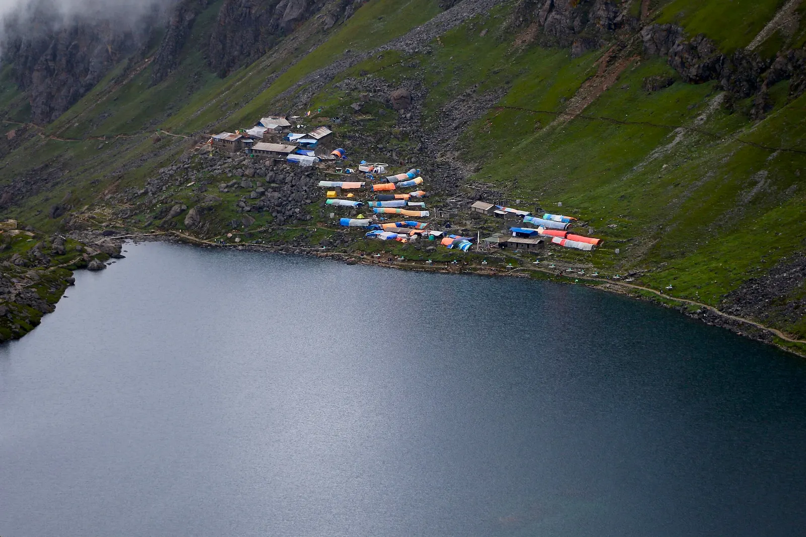
The dark water of Gosaikunda lake with a cluster of lodges with coloured roofs on the green slope above its shore.

The Langtang Valley to Kyanjin Gompa combined with the climb to the sacred Gosaikunda lakes (about 4,380 m) via Thulo Syabru and Sing Gompa, finishing at Dhunche. Check road access after the August 2026 floods.

Days
11 days
Maximum altitude
4,984 m
Difficulty
Strenuous

Questions about Gosaikunda

Is it Gosaikunda or Gosainkunda?

Both spellings refer to the same sacred lake in Langtang National Park.

How high is Gosaikunda and is altitude a risk?

The lake is at about 4,380 m, and altitude sickness is a real risk. Take at least 2-3 days from Dhunche and descend if symptoms worsen.

How do I get to Gosaikunda from Kathmandu?

Drive to Dhunche (normally 6-8 hours) and trek 2-3 days up via Chandanbari and Lauribina. Check road status after the August 2026 floods.

When is the Gosaikunda festival?

Pilgrims gather at Janai Purnima, the full moon of the month of Shrawan, which falls in July or August.

Do I need a permit for Gosaikunda?

Yes, a Langtang National Park entry permit. Check the current TIMS and guide rules as well.

More in Langtang

All of Langtang
Forested Helambu ridges with the Jugal Himal behind, seen from Bhotechaur.

Valley or region

Helambu

Hyolmo villages, monasteries and apple orchards in the hills north-east of Kathmandu, on a trek that can start from the city's edge.

Gangchempo and Dorje Lhakpa rising above the upper Langtang Valley.

Valley or region

Langtang Valley

A glacier valley north of Kathmandu, walked from Syabrubesi through forest and yak pastures to Kyanjin Gompa under Langtang Lirung.

The meeting point of the Melamchi and Indrawati rivers at Melamchi.

Town or village · 845 m

Melamchi

A river-junction market town in Sindhupalchok and the road gateway to Helambu, rebuilt after the 2021 floods.

The group of five holy lakes at Panch Pokhari seen from a viewpoint in early morning.

Lake · 4,100 m

Panch Pokhari

Five holy lakes at about 4,100 m below the Jugal Himal in Sindhupalchok, a pilgrimage at Janai Purnima and a quiet trek.

Town or village · 2,030 m

Dhunche

The district headquarters of Rasuwa and the road-side start of the Gosaikunda trail.

Trek stop · 3,330 m

Sing Gompa (Chandanbari)

A forest settlement with a small monastery on the climb to the Gosaikunda lakes.

Trek stop · 1,460 m

Syabrubesi

The road-head village in Rasuwa where the Langtang Valley trek begins.

Trek stop · 2,210 m

Thulo Syabru

A Tamang ridge village that links the Langtang Valley with the Gosaikunda trail.

Nearby

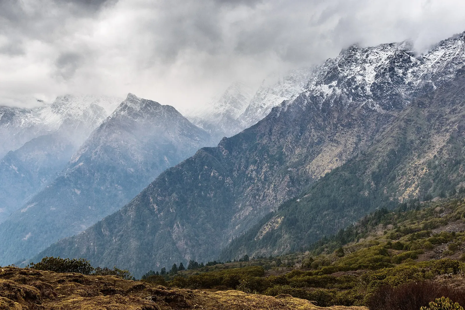
Snow-covered Himalayan peaks above the forested slopes of Langtang National Park.

Valley or region

Langtang

The trekking region closest to Kathmandu: glacier valleys, holy lakes and Hyolmo villages across Rasuwa, Nuwakot and Sindhupalchok.

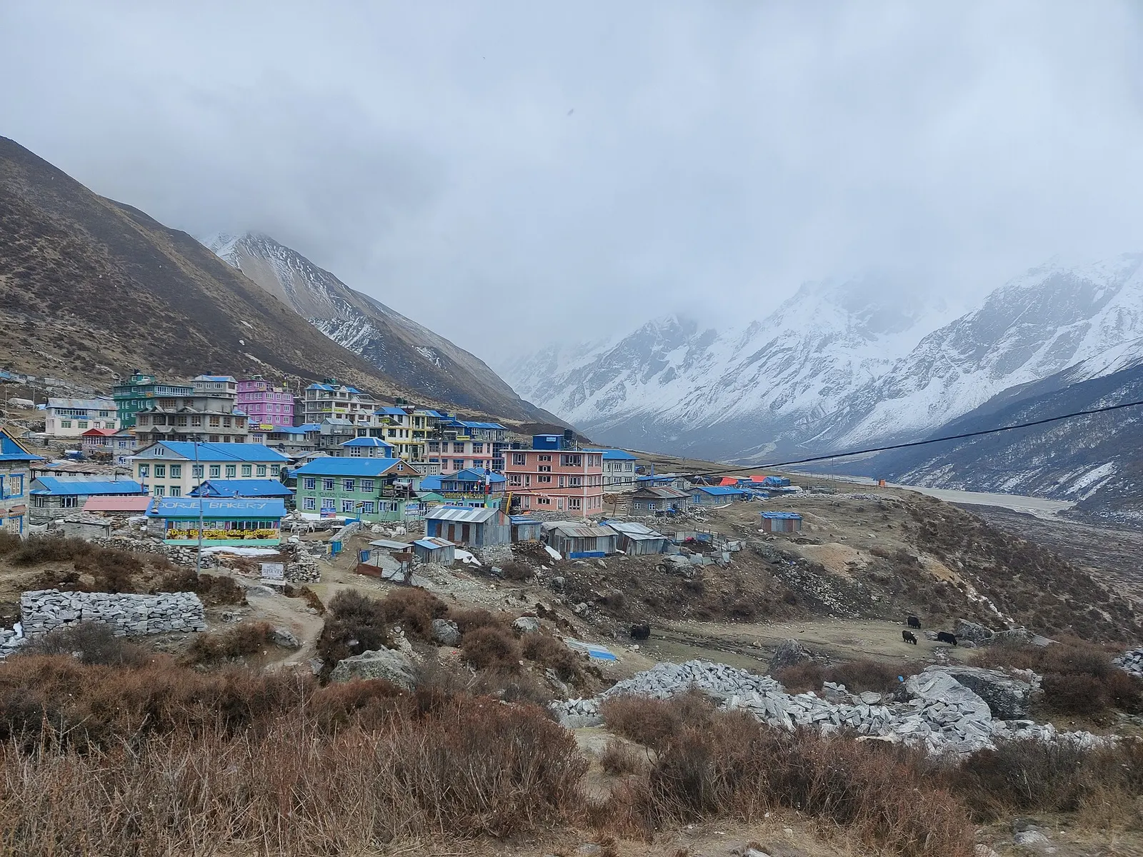
Lodges and houses of Kyanjin Gompa on the valley floor below snow peaks.

Trek stop · 3,870 m

Kyanjin Gompa

The high village and monastery at the head of the Langtang Valley trek, base for day climbs to Kyanjin Ri and Tserko Ri.

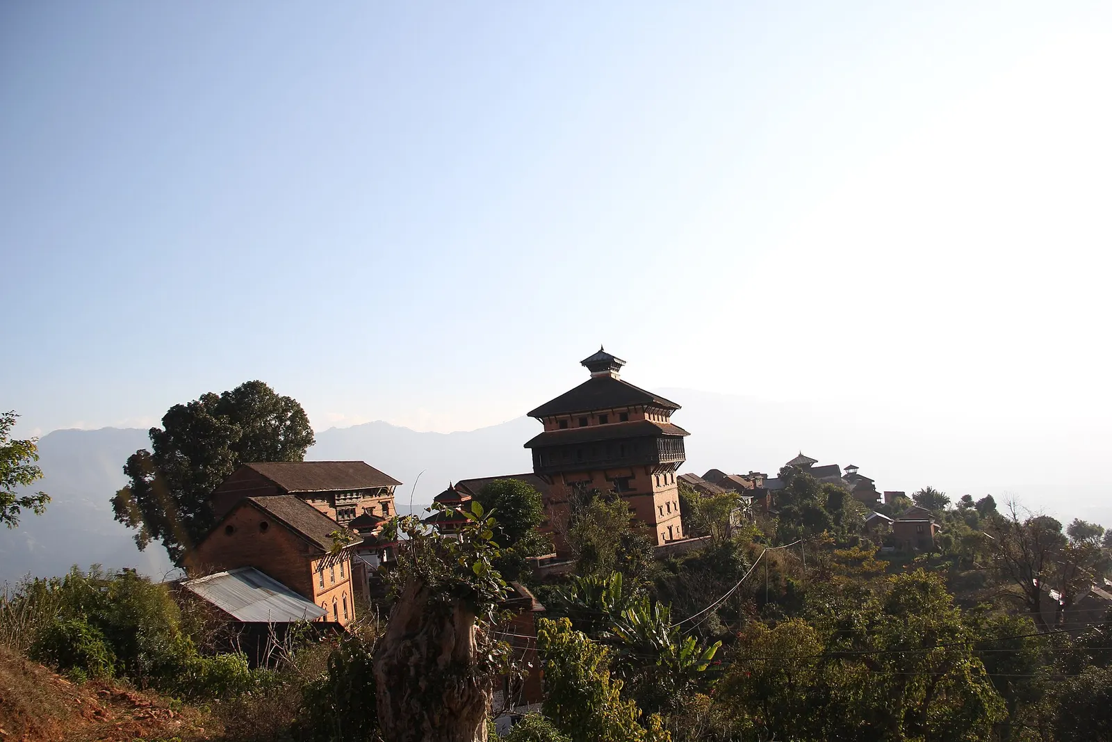
The brick and timber Nuwakot palace complex standing on its hilltop.

Temple, monastery or heritage site · 963 m

Nuwakot

A hilltop fort town above the Trishuli valley, where Prithvi Narayan Shah built a seven-storey palace during the unification of Nepal.

Editorial draft: facts are being checked against the sources below. Last checked 2026-10-06. Sources: Gosaikunda (Wikipedia), Langtang National Park (Wikipedia), Langtang National Park (Wikivoyage), Gosaikunda Rural Municipality (Wikipedia)