
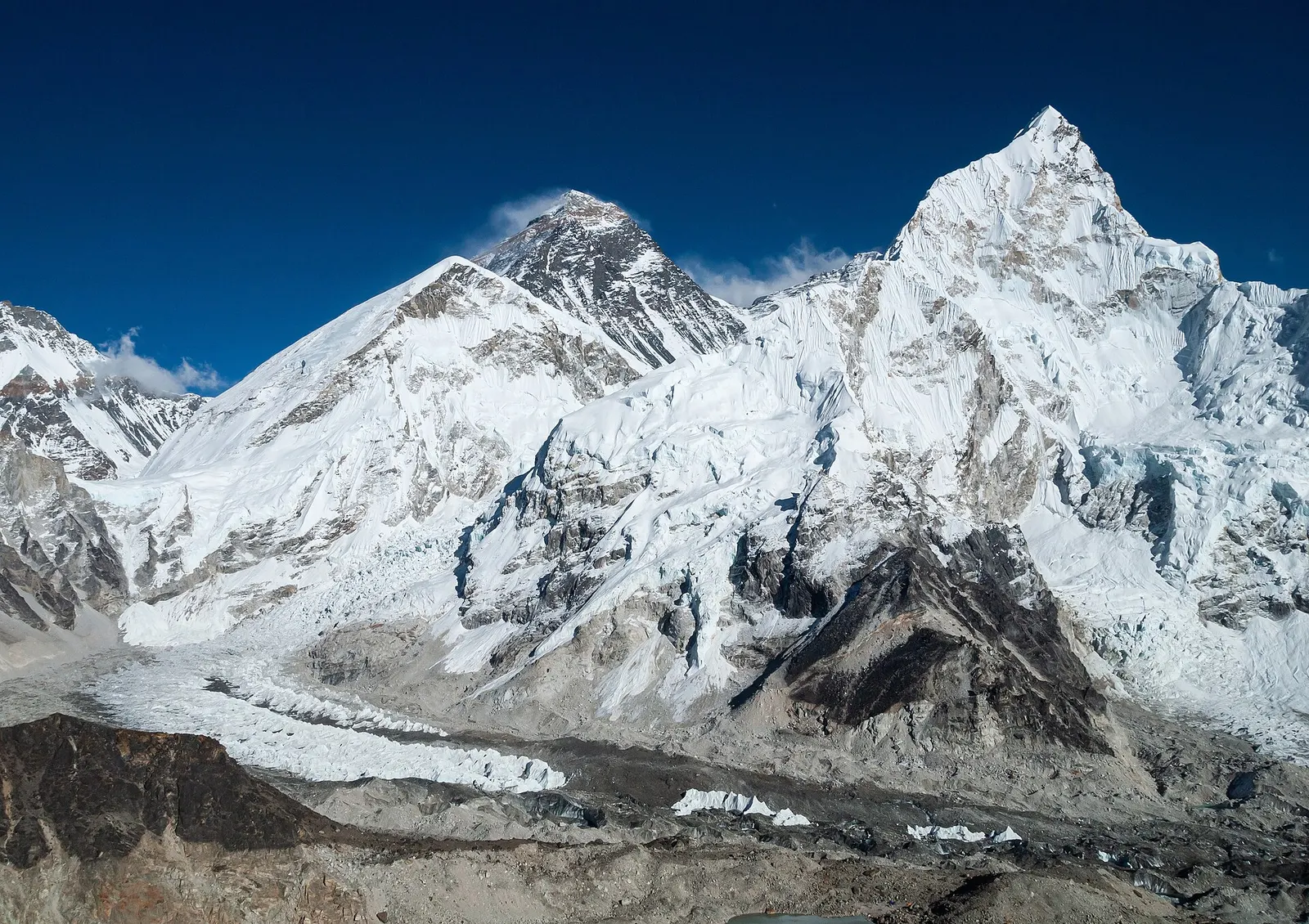
The classic teahouse trek from Lukla through Sherpa villages to Everest Base Camp (5,364 m) and the Kala Patthar viewpoint, with acclimatisation days in Namche and Dingboche.
- Days
- 12 days
- Maximum altitude
- 5,644 m
- Difficulty
- Strenuous
Everest & Khumbu, Everest Region (Khumbu)
A long, demanding circuit of the Khumbu over the Kongma La, Cho La and Renjo La, all above 5,300 m, taking in Everest Base Camp, Kala Patthar, the Gokyo Lakes and the Thame valley.
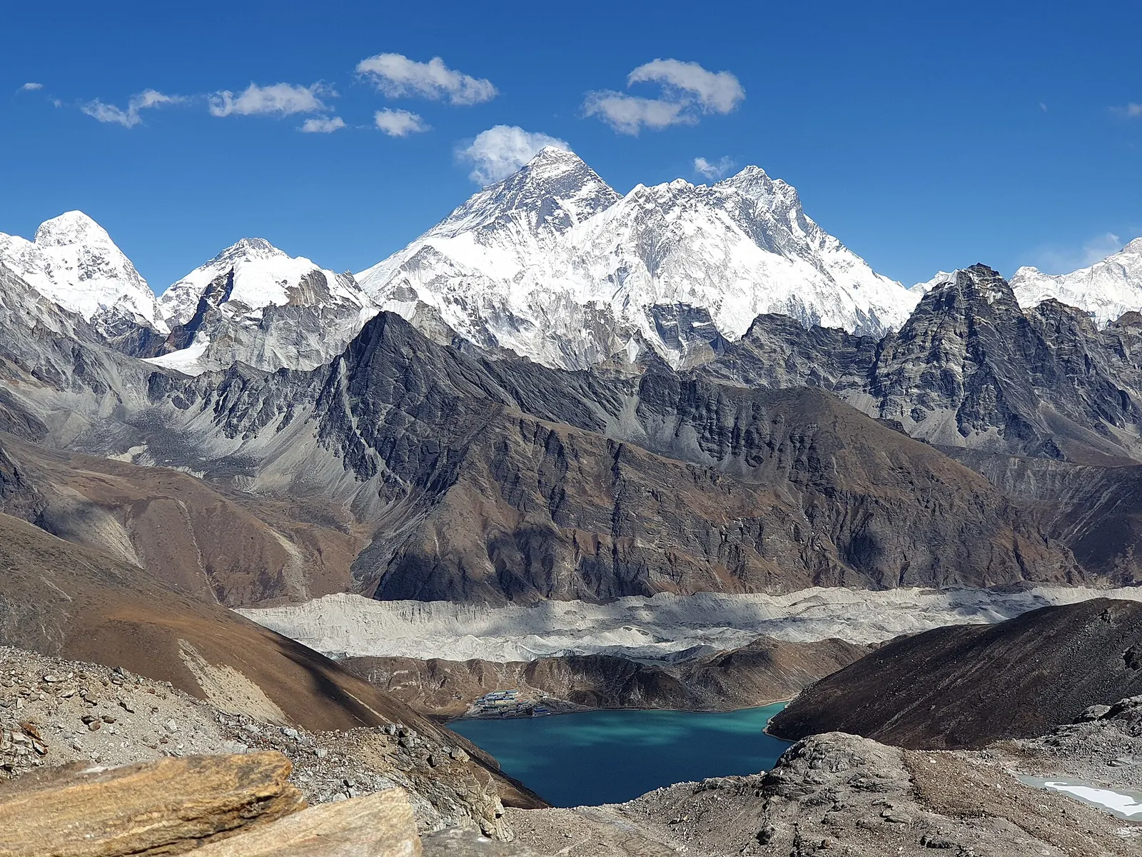
The Three High Passes trek links the main valleys of the Khumbu in one loop. From Namche Bazaar it heads east to Dingboche and Chhukung, crosses the Kongma La to Lobuche, visits Everest Base Camp and Kala Patthar, crosses the Cho La to the Gokyo Lakes, and finally crosses the Renjo La to the Bhote Koshi valley and back to Namche through Thame.
Each pass is a long day of 7 to 9 hours above 5,300 m on rough and sometimes icy ground, with no lodges between the two ends. The Kongma La is the highest, at about 5,535 m; the Cho La crosses a small glacier; the Renjo La gives a wide view back over Gokyo to Everest. In return, the route sees far more of the region than any single out-and-back trek.
The plan below follows the anticlockwise direction, which places the Kongma La after a gradual build-up through Dingboche and Chhukung. It takes about 19 days from Kathmandu without spare days. It is for experienced, fit trekkers; going with a guide who knows the passes is strongly advised.
Why it is rated challenging
Sleeping altitude for each night. The dashed lines at 3,000 m and 4,000 m mark heights where altitude illness becomes more common. General information only, not medical advice.
Hover, tap or use the arrow keys to see each day. Shaded columns are acclimatisation days.
| Day | Overnight | Sleeping altitude | High point |
|---|---|---|---|
| 1 | Phakding | 2,610 m | 2,860 m |
| 2 | Namche Bazaar | 3,440 m | - |
| 3 | Namche Bazaar (rest) | 3,440 m | 3,880 m |
| 4 | Tengboche | 3,867 m | - |
| 5 | Dingboche | 4,410 m | - |
| 6 | Dingboche (rest) | 4,410 m | 5,083 m |
| 7 | Chhukung | 4,730 m | - |
| 8 | Chhukung (rest) | 4,730 m | 5,546 m |
| 9 | Lobuche | 4,940 m | 5,535 m |
| 10 | Gorak Shep | 5,164 m | 5,364 m |
| 11 | Dzongla | 4,830 m | 5,644 m |
| 12 | Thagnak | 4,700 m | 5,420 m |
| 13 | Gokyo | 4,750 m | - |
| 14 | Gokyo (rest) | 4,750 m | 5,357 m |
| 15 | Lungden | 4,380 m | 5,360 m |
| 16 | Thame | 3,820 m | - |
| 17 | Namche Bazaar | 3,440 m | - |
| 18 | Lukla | 2,860 m | - |
| 19 | Kathmandu | 1,400 m | - |
A flight of about 25-40 minutes to the hillside airstrip at Lukla (about 2,860 m), then a gentle, mostly downhill walk along the Dudh Kosi. In busy seasons most flights leave from Manthali (Ramechhap), a 4-6 hour drive from Kathmandu, so many trekkers drive there the night before or in the early hours.
Teahouse in PhakdingAbout Phakdinghigh point Lukla, 2,860 m
Enter Sagarmatha National Park at Monjo, where permits are checked, cross the high Hillary suspension bridge and climb steadily for 2-3 hours to Namche. On a clear day there is a first glimpse of Everest from a viewpoint partway up.
Teahouse in Namche BazaarAbout Namche Bazaar
Climb to the ridge above Namche for views of Everest, Lhotse and Ama Dablam, or loop through Khumjung and Khunde, then return to sleep at the same height. Namche has the last good gear shops, pharmacies and ATMs on the route.
Teahouse in Namche BazaarAbout Namche Bazaarhigh point Viewpoints above Namche (Syangboche ridge), 3,880 m
The main base camp trail, dropping to Phunki Tenga and climbing about 600 m to the monastery. Deboche, just beyond, is an alternative overnight.
Teahouse in TengbocheAbout Tengboche
Through Pangboche and above the tree line into the Imja valley.
Teahouse in DingbocheAbout Dingboche
Climb the ridge behind the village and return to sleep at the same height.
Teahouse in DingbocheAbout Dingbochehigh point Nangkartshang ridge, 5,083 m
A short walk up the Imja valley below the Lhotse and Nuptse walls. Rest in the afternoon or walk a little higher and come back down.
Teahouse in ChhukungAbout Chhukung
A steep climb to the Chhukung Ri viewpoint for Lhotse, Makalu and Ama Dablam, then back to Chhukung. This day prepares you for the Kongma La; skip the top if you feel unwell.
Teahouse in ChhukungAbout Chhukunghigh point Chhukung Ri, 5,546 m
Climb past small frozen lakes to the pass, descend a steep, loose slope and cross the rubble of the Khumbu Glacier to Lobuche. There are no lodges on the way; start at first light and carry water and food.
Teahouse in LobucheAbout Lobuchehigh point Kongma La, 5,535 m
Along the moraine to Gorak Shep, then a round trip of about 3-4 hours to the base camp area.
Teahouse in Gorak ShepAbout Gorak Shephigh point Everest Base Camp, 5,364 m
Climb Kala Patthar for sunrise over Everest, return to Gorak Shep, then walk back past Lobuche and branch west on a high traverse above Chola Tsho to Dzongla. If tired, stop at Lobuche and walk to Dzongla the next morning.
Teahouse in DzonglaAbout Dzonglahigh point Kala Patthar, 5,644 m
A rocky climb to the glacier below the pass, a crossing on snow or ice to the top, then a steep boulder descent into the Gokyo valley. Microspikes are often needed; do not cross in poor visibility.
Teahouse in Thagnak (Dragnag)About Thagnakhigh point Cho La, 5,420 m
Cross the rubble-covered Ngozumpa Glacier on a cairned path that changes from year to year, to Gokyo village on the third lake. A short day for recovery.
Teahouse in GokyoAbout Gokyo
Climb Gokyo Ri for sunrise on Everest, Lhotse, Makalu and Cho Oyu, then rest before the last pass. The fourth lake is an optional afternoon walk.
Teahouse in GokyoAbout Gokyohigh point Gokyo Ri, 5,357 m
Along the lakeshore and up stone steps to the pass, with a wide view back over Gokyo to Everest. The western descent can hold snow and ice.
Teahouse in LungdenAbout Lungdenhigh point Renjo La, 5,360 m
Down the quiet Bhote Koshi valley through Marlung and Taranga to Thame, with its cliffside monastery. Check the state of the trail and lodges after the 2024 flood.
Teahouse in ThameAbout Thame
An easy walk east through Thamo and Phurte, back to Namche.
Teahouse in Namche BazaarAbout Namche Bazaar
A long final day down to the Dudh Kosi, through Monjo and Phakding, and back up to Lukla. Reconfirm your flight in the evening.
Teahouse in LuklaAbout Lukla
An early morning flight, weather permitting, to Kathmandu or Manthali (Ramechhap). Delays of a day or more are common, so do not book an international flight for the same or next day.
Hotel in KathmanduAbout Kathmandu
Stages, times and altitudes vary by operator, weather and pace. Partner agencies confirm the exact plan.
Trail geometry from OpenStreetMap.
Sagarmatha National Park entry permitNational park
Issued for the Department of National Parks and Wildlife Conservation, in Kathmandu or at the park entrance near Monjo.
Khumbu Pasang Lhamu Rural Municipality entry permitLocal
A local government permit (trekker card) collected in Lukla or at the checkpost just north of it. In the Khumbu it has taken the place of the TIMS card; check whether a TIMS card is currently required.
Gaurishankar Conservation Area permitConservation area
Only needed if you walk in from Jiri or Shivalaya instead of flying to Lukla.
Verify before travel: permit rules and fees change. Checked 2026-10-06 against Department of National Parks and Wildlife Conservation. Guide rule: The Kathmandu Post: Everest region, Nepal Tourism Board dispute over solo trek ban (3 April 2023).
Nepal trekking permits explainedBest months: Apr-May, Oct-Nov
Nearest hub: Lukla. Times are typical ranges, not schedules, and vary with roadworks, weather and the season.
By airfrom Kathmanduabout 0.4-0.7 hLukla (Tenzing-Hillary)often delayed or cancelled by weather
Fly Kathmandu or Ramechhap to Lukla, 25-40 minutes weather permitting, then walk 3-4 h down the valley. In the busy seasons most flights leave from Ramechhap (Manthali), a 3-4 hour drive east of Kathmandu, with a very early start.
When to set off: Lukla flights are scheduled at first light, before the south-west wind builds from mid to late morning; Ramechhap departures leave Kathmandu by road around 03:00-04:00
On footfrom Luklaabout 3-4 h3-4 h from Lukla, about 7-8 km, mostly descending with a few short climbs and a net loss of roughly 250 m
The first afternoon of the trek, walked straight off the flight.
When to set off: teahouse stages start after breakfast, usually by 07:30, to arrive before the afternoon cloud and wind
Typical seasonal exposure along the route, merged from the stops that have a place page. Seasonal patterns only, never conditions today.
Altitudehigh in a typical yearAll year
The region runs from about 2,600 m at Phakding to about 5,360 m at Everest Base Camp, and most itineraries sleep above 4,000 m for several nights. Acute mountain sickness is common on fast ascents - it affects roughly 40 per cent of people who go up quickly to 3,000 m, and more above that. General information, not medical advice: gain height slowly, keep sleeping-height gains small (about 300 m a day once high), build in rest days, learn the symptoms - headache, nausea, breathlessness, broken sleep - and descend if they get worse. See a doctor before travelling and carry insurance that covers helicopter evacuation.
Recorded for Everest Region (Khumbu), Namche Bazaar, Tengboche, Dingboche and 9 more. Altitude sickness - Wikipedia
Snowhigh in a typical yearNov-Apr
Deep winter snow can block the trails above Tengboche, and spring storms leave fresh snow on the higher stages; December to March is the usual snow window at this height.
Recorded for Everest Region (Khumbu), Phakding, Namche Bazaar, Tengboche and 10 more. Everest Base Camp Trek - Wikivoyage
Seasonal closurehigh in a typical yearJun-Sep, Dec-Feb
Lukla flights are the weak link in the monsoon: poor visibility stops operations at the airstrip about half the time in that season and about half of flights are cancelled, and waits of several days happen. Any itinerary built on the flight needs spare days at both ends.
Recorded for Everest Region (Khumbu), Phakding, Namche Bazaar, Tengboche and 10 more. Tenzing-Hillary Airport - Wikipedia
Coldhigh in a typical yearNov-Mar
Nights are far below freezing from November to March at this height, with wind on the open moraine and unheated bedrooms in the teahouses; a winter-rated sleeping bag and down layer are the norm.
Recorded for Everest Region (Khumbu), Phakding, Namche Bazaar, Tengboche and 11 more. Everest Base Camp Trek - Wikivoyage
Road blockageshigh in a typical yearJun-Sep
The mountain roads into Solukhumbu turn muddy and slippery in the monsoon and landslides are possible, so road journeys from Kathmandu run much slower in June to September.
Recorded for Everest Region (Khumbu), Lukla, Kathmandu. Kathmandu to Dhap Village - Himalayan Masters
Floodinghigh in a typical yearMay-Sep
Thame was inundated by a glacial lake outburst flood on 16 August 2024, which destroyed at least 15 structures. Outburst floods from the glacial lakes above the valley are most likely in the warm, wet months, and the village sits on the valley floor.
Recorded for Everest Region (Khumbu), Dingboche, Chhukung, Lungden and 2 more. Thame, Nepal - Wikipedia
Othermoderate in a typical yearAll year
Flights are scheduled in the early morning year-round: the wind usually blows from the north-east at dawn and turns to a strong south-west flow from mid to late morning, when the airstrip regularly stops operating.
Recorded for Everest Region (Khumbu), Phakding, Namche Bazaar, Tengboche and 11 more. Tenzing-Hillary Airport - Wikipedia
River crossingsmoderate in a typical yearJun-Sep
The route crosses and recrosses the Dudh Koshi on suspension bridges between Lukla and Namche; the river runs high through the monsoon and the bridge approaches are slippery then.
Recorded for Everest Region (Khumbu), Phakding, Namche Bazaar, Lukla. Everest Base Camp Trek - Wikivoyage
Landslidesmoderate in a typical yearJun-Sep
The highways into the valley cross steep hill country, and monsoon landslides typically block sections of the Prithvi Highway and the other approach roads, so overland arrival days are unpredictable in July and August.
Recorded for Kathmandu. 2024 Nepal floods, Wikipedia
Check current conditions before you travel
Nothing here describes the Three High Passes Trek today. Trail, road, pass and flight conditions change with the weather and with roadworks. Check the Department of Hydrology and Meteorology, the Nepal Disaster Risk Reduction Portal and the local authority or your licensed operator before and during the trek.
Forecasts for start (Phakding, 2,610 m), highest overnight (Gorak Shep, 5,164 m), end (Kathmandu, 1,400 m). Mountain weather changes fast; check again on the day.
Forecast for 2,610 m. Conditions change fast in the mountains.
Weather data: MET Norway, licensed CC BY 4.0. A forecast, not a guarantee.
Forecast for 5,164 m. Conditions change fast in the mountains.
Weather data: MET Norway, licensed CC BY 4.0. A forecast, not a guarantee.
Forecast for 1,400 m. Conditions change fast in the mountains.
Weather data: MET Norway, licensed CC BY 4.0. A forecast, not a guarantee.
A climbing peak reached from Chhukung; it needs a climbing permit, mountaineering equipment and experience, and is not part of the trek.
From Gokyo, a walk north along the Ngozumpa Glacier to Thonak Tsho and beyond, 6-8 hours return.
A Sherpa village above Namche, an easy loop on the acclimatisation day.
About 19 days from Kathmandu back to Kathmandu in the plan here, or 17-21 days depending on acclimatisation and spare days. Add one or two days for Lukla flight delays and bad weather on the passes.
It is a very demanding teahouse trek: three passes above 5,300 m, each a 7-9 hour day, a short glacier crossing on the Cho La and two weeks above 4,000 m. It suits experienced, well-acclimatised trekkers.
Many trekkers go anticlockwise, as here, crossing the Kongma La first after acclimatising in Dingboche and Chhukung. Going clockwise puts the Renjo La first, which means gaining height faster unless extra nights are added.
The Sagarmatha National Park entry permit and the Khumbu Pasang Lhamu Rural Municipality permit. Check current rules and fees before you go.
The national rule from April 2023 requires a licensed guide in parks and conservation areas, though the Khumbu municipality has not made guides mandatory in its area. Either way, a guide who knows the passes is strongly advised for route finding and safety.
Yes. The most common shorter version crosses only the Cho La between Everest Base Camp and Gokyo; the Renjo La can be added to return via Thame.
The classic teahouse trek from Lukla through Sherpa villages to Everest Base Camp (5,364 m) and the Kala Patthar viewpoint, with acclimatisation days in Namche and Dingboche.
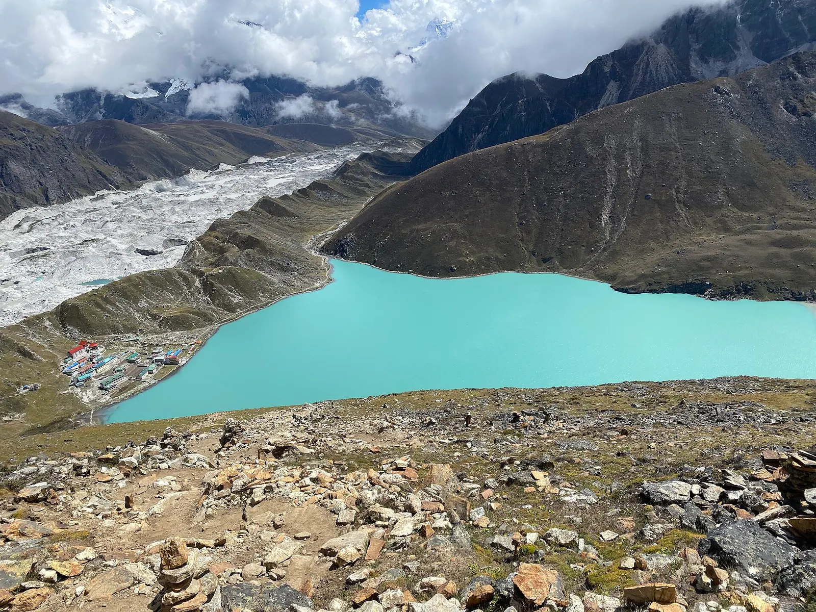
A teahouse trek from Lukla up the Dudh Kosi valley to the turquoise Gokyo Lakes beside the Ngozumpa Glacier, with a dawn climb of Gokyo Ri (about 5,357 m) for views of four 8,000 m peaks.
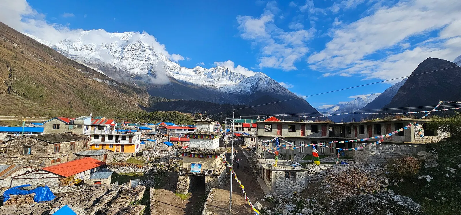
A restricted-area teahouse trek around Manaslu (8,163 m), up the Budhi Gandaki gorge through Gurung and Nubri villages, over the Larkya La (about 5,106 m) and down to Dharapani on the Annapurna Circuit.
Three High Passes · 19 days