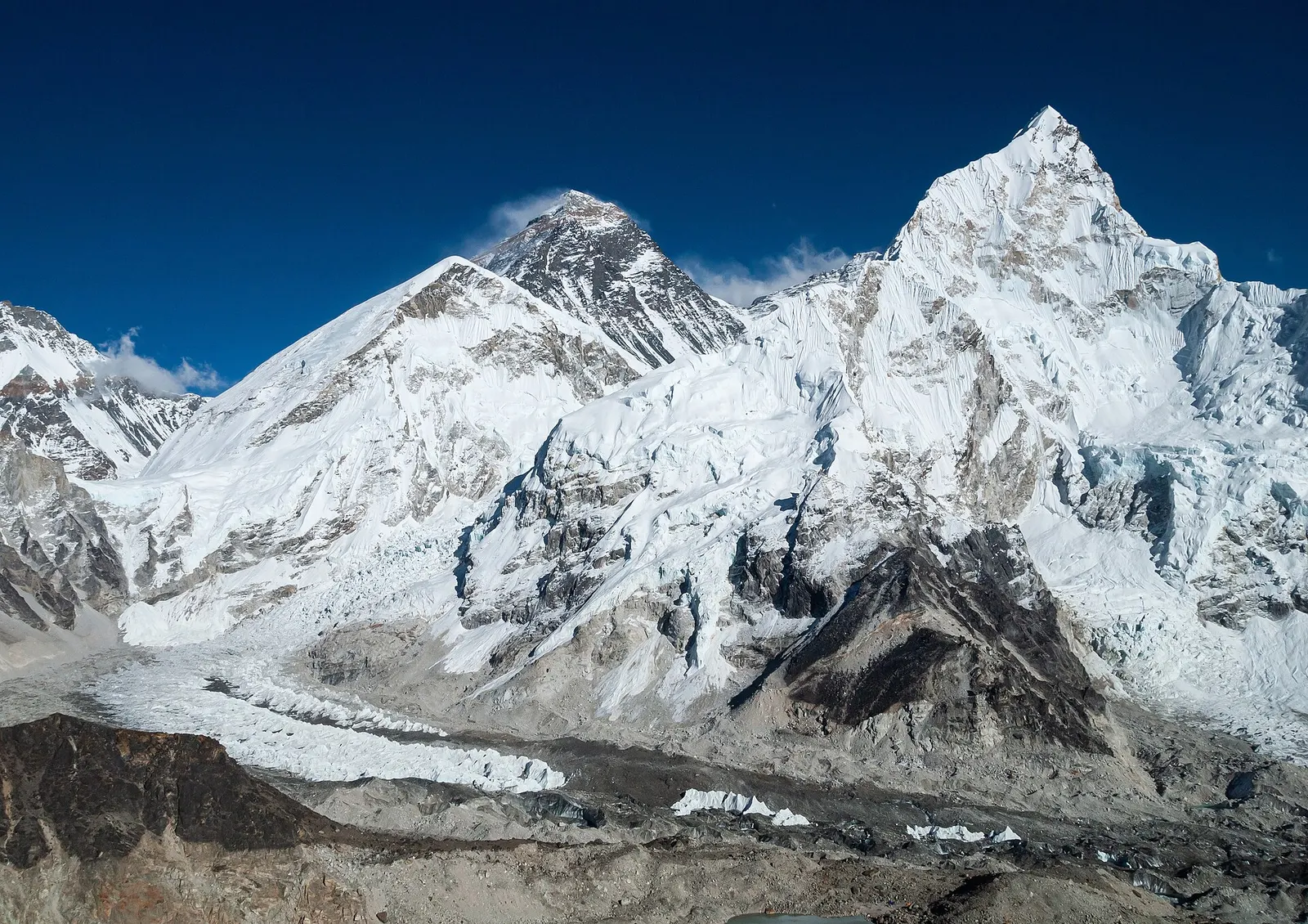
The classic teahouse trek from Lukla through Sherpa villages to Everest Base Camp (5,364 m) and the Kala Patthar viewpoint, with acclimatisation days in Namche and Dingboche.
- Days
- 12 days
- Maximum altitude
- 5,644 m
- Difficulty
- Strenuous
Everest Region (Khumbu)गोक्यो ताल
A chain of glacier-fed lakes beside the Ngozumpa glacier, with views of Everest and Cho Oyu from the hill of Gokyo Ri.
Higher seasonal exposure: altitude (All year), snow (Dec-Mar), cold (Nov-Mar), seasonal closure (Jun-Sep).
The Gokyo Lakes are a string of turquoise glacial lakes at the head of the Dudh Kosi valley in the western part of Khumbu, between about 4,700 and 5,000 m. Six main lakes and a number of smaller pools lie in a trough on the west side of the Ngozumpa glacier, one of the longest glaciers in the Himalaya, which descends from Cho Oyu. Within the Everest region they are the main alternative to the base camp route, quieter and with arguably wider views.
Gokyo village, a cluster of lodges, sits on the eastern shore of the third lake, Gokyo Cho (also called Dudh Pokhari). The classic excursion is the climb of Gokyo Ri, about 5,360 m, directly above the village, which takes in Everest, Lhotse, Makalu and Cho Oyu, four of the world's 8,000 m peaks, along with the grey expanse of the glacier below. Walks north along the lakes reach the fourth and fifth lakes and the Ngozumpa Tse viewpoint.
The lakes can be the goal of a trek in their own right, typically 10-12 days return from Lukla, or linked with Everest Base Camp over the Cho La pass and with the Thame valley over the Renjo La for experienced trekkers.
The system was designated a Ramsar wetland of international importance in 2007. Thonak Cho, the fourth lake, is the largest and deepest, measured at about 62 m. The lakes sit on a fragile moraine, and changes in the Ngozumpa glacier are a long-term risk to them.
The lakes are sacred to both Buddhists and Hindus. During the Janai Purnima festival, usually in August, Hindu pilgrims come to bathe in the lakes, and Sherpa communities regard them as the dwelling place of deities, so washing, swimming and throwing rubbish into them is inappropriate. Gokyo itself was traditionally a summer grazing settlement used by herders from lower villages before lodges were built for trekkers; much of the valley is still used for yak grazing in summer.
Climb Gokyo Ri
About 2-3 hours up from the village, gaining around 600 m; go for sunrise or late afternoon light on Everest.
Walk to the fourth and fifth lakes
A long day hike north along the lake chain to Thonak Cho and beyond, with views of Cho Oyu.
Glacier viewpoints
Climb the lateral moraine east of the village to look across the rubble-covered Ngozumpa glacier.
Cross the Cho La or Renjo La
Experienced trekkers link Gokyo with Everest Base Camp or the Thame valley; both passes are high, can be icy and need good conditions.
Forecast for 4,750 m. Conditions change fast in the mountains.
Weather data: MET Norway, licensed CC BY 4.0. A forecast, not a guarantee.
Apr-May, Oct-Nov
Gokyo village has several lodges with similar facilities; rooms are cold and dining rooms are heated in the evenings.
No partner stays are listed here yet. List a property.
Gokyo is reached on foot from Namche Bazaar in about 3-4 days, gaining height slowly via Dole and Machhermo.
Nearest hub: Lukla (Tenzing-Hillary Airport)
Nearest hub: Lukla. Times are typical ranges, not schedules, and vary with roadworks, weather and the season.
By airfrom Kathmanduabout 0.4-0.7 hLukla (Tenzing-Hillary)often delayed or cancelled by weather
A 25-40 minute mountain flight to Lukla, weather permitting, then the walk in. In the busy seasons most flights leave from Ramechhap (Manthali) instead of Kathmandu, a 3-4 hour drive east, which means a night-time road transfer. Cancellations for wind and visibility are routine, so spare days belong in the plan.
When to set off: Lukla flights are scheduled at first light, before the south-west wind builds from mid to late morning; Ramechhap departures leave Kathmandu by road around 03:00-04:00
On footfrom Machhermoabout 4-5 h4-5 h from Machhermo, roughly 300-350 m of ascent past the first and second lakes
Usually the third or fourth day from Namche, after an acclimatisation night at Dole or Machhermo.
When to set off: teahouse stages start after breakfast, usually by 07:30, to arrive before the afternoon cloud and wind
Permit required
The lakes are inside Sagarmatha National Park; the park permit and the Khumbu Pasang Lhamu Rural Municipality permit apply. Check whether a TIMS card is currently required.
Verify before travel: permit rules and fees change. Checked 2026-10-06 against Department of National Parks and Wildlife Conservation.
On the Gokyo Lakes trek, Three Passes trek, Gokyo and Everest Base Camp via Cho La.
What this place is typically exposed to, and when. These are seasonal patterns, not a report on conditions now.
Altitudehigh in a typical yearAll year
Gokyo village sits at about 4,750-4,790 m and Gokyo Ri above it at about 5,360 m. Acute mountain sickness is common on fast ascents - it affects roughly 40 per cent of people who go up quickly to 3,000 m, and more above that. General information, not medical advice: gain height slowly, keep sleeping-height gains small (about 300 m a day once high), build in rest days, learn the symptoms - headache, nausea, breathlessness, broken sleep - and descend if they get worse. See a doctor before travelling and carry insurance that covers helicopter evacuation.
Snowhigh in a typical yearDec-Mar
Deep winter snow can block the trails above Tengboche, and spring storms leave fresh snow on the higher stages; December to March is the usual snow window at this height.
Coldhigh in a typical yearNov-Mar
Nights are far below freezing from November to March at this height, with wind on the open moraine and unheated bedrooms in the teahouses; a winter-rated sleeping bag and down layer are the norm.
Seasonal closurehigh in a typical yearJun-Sep
Lukla flights are the weak link in the monsoon: poor visibility stops operations at the airstrip about half the time in that season and about half of flights are cancelled, and waits of several days happen. Any itinerary built on the flight needs spare days at both ends.
Seasonal closuremoderate in a typical yearDec-Feb
Above Tengboche many teahouses do not stay open through the deep-winter months, so the high stages are seldom walked in December to February and food and beds are harder to find.
Othermoderate in a typical yearAll year
The crossing of the Ngozumpa Glacier to Thagnak, and the Cho La beyond it, run over moving ice and loose moraine; the Cho La can need crampons on the small glacier at the top and parties ask for information on the route before setting out.
Otherlow in a typical yearJun-Aug
The monsoon brings cloud and rain rather than views, and the stages are wet and misty underfoot, although the upper valleys get less rain than the forest below.
Check current conditions before you travel
Roads, trails, passes and flights change with the weather and with roadworks, and nothing on this page describes conditions today. Before you set off, check the Department of Hydrology and Meteorology for weather and flood warnings, the Nepal Disaster Risk Reduction Portal for incidents, and the local authority, police or your licensed operator for road, trail and flight status.
The classic teahouse trek from Lukla through Sherpa villages to Everest Base Camp (5,364 m) and the Kala Patthar viewpoint, with acclimatisation days in Namche and Dingboche.
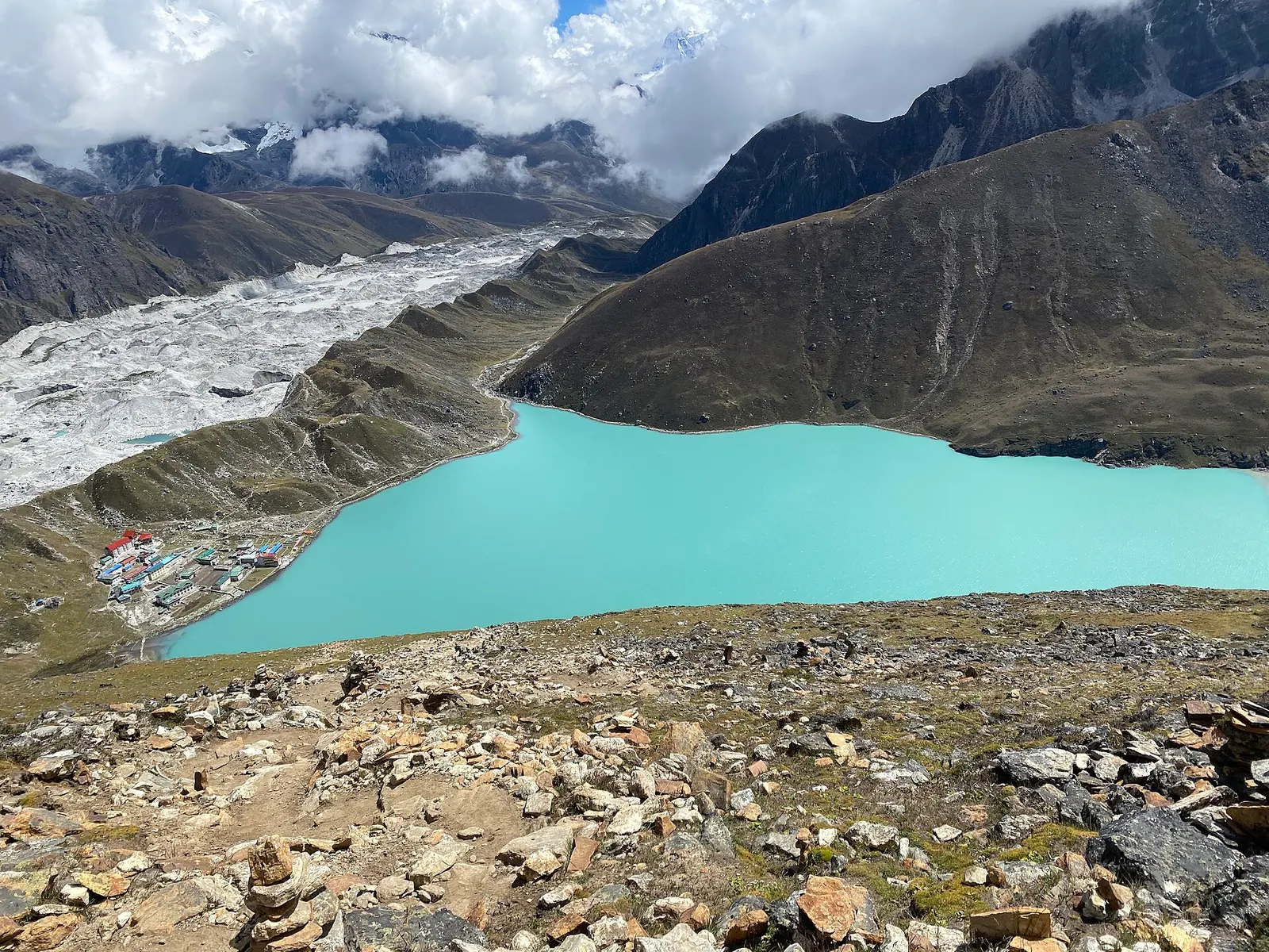
A teahouse trek from Lukla up the Dudh Kosi valley to the turquoise Gokyo Lakes beside the Ngozumpa Glacier, with a dawn climb of Gokyo Ri (about 5,357 m) for views of four 8,000 m peaks.
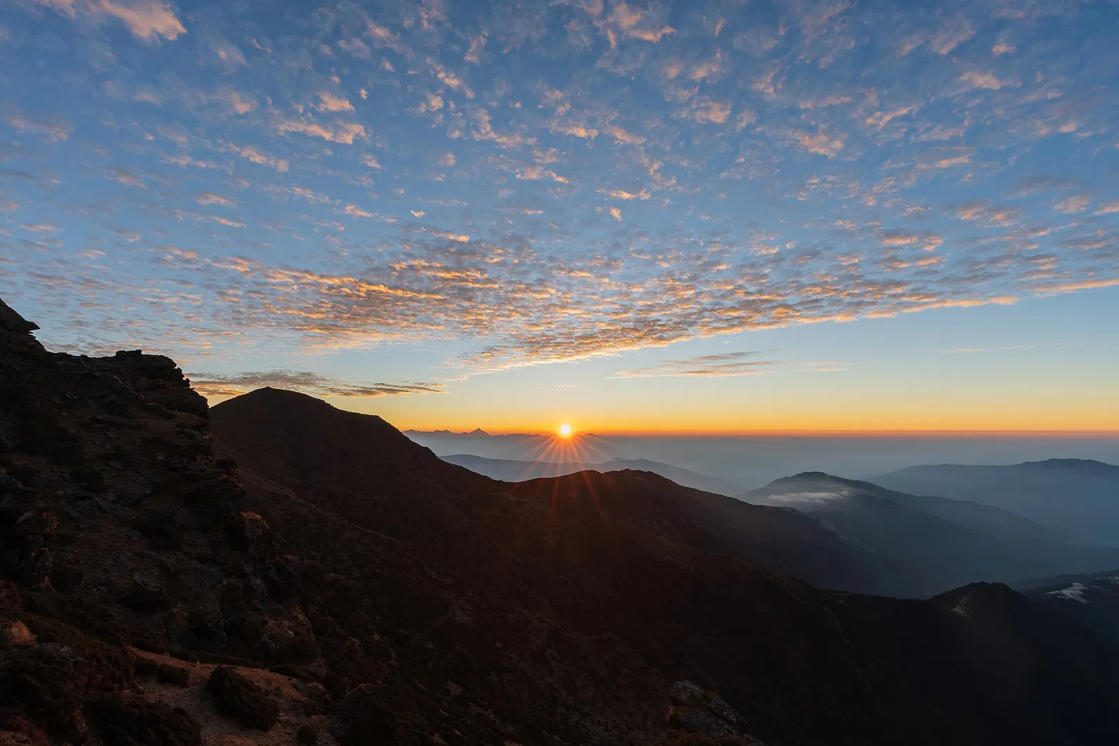
A short, lower trek in Solu, the southern part of Solukhumbu, to the grassy summit of Pikey Peak (about 4,065 m) for a long Himalayan panorama including Everest, then down to Junbesi and Phaplu.
Fly to Lukla, walk two days to Namche Bazaar, then 3-4 more days via Dole and Machhermo to Gokyo.
The lakes are at about 4,700-5,000 m and Gokyo Ri is about 5,360 m, so altitude sickness is a real risk; a slow ascent is essential.
Yes, the lakes are inside Sagarmatha National Park, so the park permit and the local Khumbu permit are needed.
Yes, from Gokyo Ri above the village on clear days, along with Lhotse, Makalu and Cho Oyu.
Viewpoint · 5,644 m
A dark ridge-top viewpoint above Gorak Shep with a close view of Everest, Nuptse and the Khumbu Glacier.
Viewpoint · 4,065 m
A grassy 4,065 m summit in lower Solukhumbu with a long view of the eastern Himalaya, reached on a short trek through Sherpa villages.
Trek stop · 4,730 m
A high lodge settlement at the head of the Imja valley, below Lhotse's south face and Island Peak.
Mountain pass · 5,420 m
A glaciated pass linking the Everest Base Camp trail with the Gokyo valley, crossed between Dzongla and Thagnak.
Trek stop · 4,410 m
A walled-field Sherpa village in the Imja valley, the usual acclimatisation stop on the way to Everest Base Camp.
Trek stop · 4,038 m
A small lodge village in the upper Dudh Kosi valley, the first night above Namche on the way to Gokyo.
Trek stop · 4,830 m
A tiny lodge stop on a high pasture below Cholatse, the eastern base for crossing the Cho La.
Trek stop · 5,164 m
The last lodges below Everest Base Camp, on a sandy dry lakebed beneath Kala Patthar.
Valley or region
The Sherpa homeland below Everest, reached on foot from Lukla through stone villages, monasteries and glacial valleys.