
Lake · 4,750 m
Gokyo Lakes
A chain of glacier-fed lakes beside the Ngozumpa glacier, with views of Everest and Cho Oyu from the hill of Gokyo Ri.
Everest & Khumbuसगरमाथा क्षेत्र (खुम्बु)
Sherpa villages, monasteries and glacier valleys below the highest mountain on Earth.
This is the Everest or Khumbu trekking region in Solukhumbu district, Nepal, not the summit of Mount Everest itself.
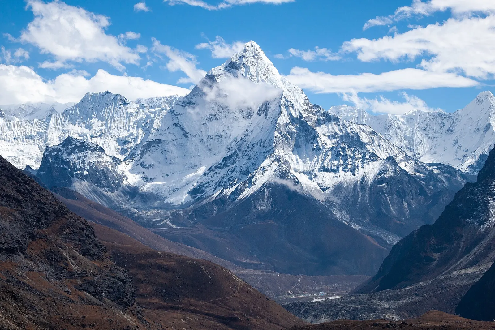
Higher seasonal exposure: altitude (All year), snow (Dec-Mar), cold (Nov-Mar), seasonal closure (Jun-Sep), road blockages (Jun-Sep), snow (Nov-Apr).
The Everest region, known locally as Khumbu, is the high valley system in northern Solukhumbu where the Dudh Kosi and its tributaries drain the south side of Everest, Lhotse, Cho Oyu and their neighbours. Most of it lies inside Sagarmatha National Park, a protected area of about 1,148 square km that rises from roughly 2,845 m at Monjo to the summit of Everest. There are no roads in the upper valleys, so everything moves on foot, by porter, by yak or by helicopter, and the lodges and villages along the trails form one of the best-supplied trekking networks in the Himalaya.
Treks usually begin with a short mountain flight to Lukla. From there the main trail climbs north through Phakding, a first-night stop beside the river, to Namche Bazaar, the market town and acclimatisation base. Above Namche the routes divide. The classic Everest Base Camp trek heads east via Tengboche monastery, Dingboche and Lobuche to Gorak Shep and the viewpoint of Kala Patthar. The Gokyo route turns north up the Dudh Kosi to a chain of turquoise glacial lakes beside the Ngozumpa glacier. The quieter Thame valley leads west towards the Renjo La. Khumjung, a large Sherpa village on a shelf above Namche, is a common detour on acclimatisation days.
Outside the national park, lower Solukhumbu offers shorter, lower walks. Pikey Peak, a ridge-top viewpoint at about 4,065 m in the south of the district, gives a long panorama of the high peaks without the altitude of the base camp routes. Each child page in this section covers one of these stops in detail.
The story
To the Sherpas the mountain is Chomolungma, often translated as Goddess Mother of the World. The mountain goddess Miyolangsangma, who rides a tiger, is believed to grant safe passage, and expeditions hold a puja ceremony at base camp to ask her permission before climbing. Many Sherpa climbers will not set foot on the mountain until it has been done.
Lake · 4,750 m
A chain of glacier-fed lakes beside the Ngozumpa glacier, with views of Everest and Cho Oyu from the hill of Gokyo Ri.
Viewpoint · 5,644 m
A dark ridge-top viewpoint above Gorak Shep with a close view of Everest, Nuptse and the Khumbu Glacier.
Viewpoint · 4,065 m
A grassy 4,065 m summit in lower Solukhumbu with a long view of the eastern Himalaya, reached on a short trek through Sherpa villages.
Trek stop · 4,730 m
A high lodge settlement at the head of the Imja valley, below Lhotse's south face and Island Peak.
Mountain pass · 5,420 m
A glaciated pass linking the Everest Base Camp trail with the Gokyo valley, crossed between Dzongla and Thagnak.
Trek stop · 4,410 m
A walled-field Sherpa village in the Imja valley, the usual acclimatisation stop on the way to Everest Base Camp.
Trek stop · 4,038 m
A small lodge village in the upper Dudh Kosi valley, the first night above Namche on the way to Gokyo.
Trek stop · 4,830 m
A tiny lodge stop on a high pasture below Cholatse, the eastern base for crossing the Cho La.
Trek stop · 5,164 m
The last lodges below Everest Base Camp, on a sandy dry lakebed beneath Kala Patthar.
Trek stop · 2,675 m
A Solu Sherpa village of stone houses and fields on the old Jiri to Everest trail, below Pikey Peak.
Town or village · 3,790 m
A large Sherpa village on a high shelf above Namche, home to the Hillary school and a monastery that keeps a reputed yeti scalp.
Mountain pass · 5,535 m
The highest of the three passes, between Chhukung and Lobuche, with a crossing of the Khumbu Glacier on the far side.
Trek stop · 4,940 m
A cluster of high lodges beside the Khumbu Glacier moraine, the last stop before Gorak Shep and base camp.
Trek stop · 2,860 m
The airstrip town where most Everest region treks begin and end, on a shelf above the Dudh Kosi.
Trek stop · 4,380 m
A remote lodge stop in the upper Bhote Koshi valley, the western end of the Renjo La crossing.
Trek stop · 4,470 m
A lodge village below the snout of the Ngozumpa Glacier, a step on the way up to Gokyo.
Town or village · 3,440 m
The Sherpa market town of Khumbu, built in tiers around a hillside bowl and used by most trekkers as their acclimatisation base.
Trek stop · 2,610 m
A riverside lodge village on the Dudh Kosi, the usual first night on the trail from Lukla towards Namche.
Trek stop · 2,413 m
A small airstrip town near Salleri, the road head and end point for Pikey Peak and lower Solukhumbu treks.
Trek stop · 4,371 m
A windy valley-floor village with a seasonal mountain aid post, used by Everest trekkers on the way up or down.
Mountain pass · 5,360 m
A high pass west of Gokyo with a wide view back over the lakes to Everest, linking Gokyo with the Thame valley.
Trek stop · 3,867 m
A ridge-top monastery village between Namche and Dingboche, facing Ama Dablam, Everest and Lhotse.
Trek stop · 4,700 m
A few lodges on the east edge of the Ngozumpa Glacier, the western end of the Cho La crossing.
Trek stop · 3,820 m
A Sherpa village west of Namche with an old cliffside monastery and a long line of famous mountaineers.
Khumbu is the homeland of the Sherpa people, whose ancestors migrated from eastern Tibet several centuries ago and settled as farmers, herders and traders on the Nangpa La route to Tibet. Tibetan Buddhism shapes daily life: villages are marked by mani walls carved with prayers, chortens and prayer flags, and monasteries such as Tengboche, Pangboche and Thame hold the Mani Rimdu masked-dance festival in the autumn or spring, depending on the monastery. Walk to the left of mani walls and chortens, keeping them on your right.
Mountaineering transformed the region after Tenzing Norgay and Edmund Hillary reached the summit of Everest in 1953. Hillary's Himalayan Trust later built schools, clinics and bridges, including the school at Khumjung in 1961. Tourism began in the early 1960s, the national park was established in 1976 and inscribed on the World Heritage List in 1979, and today most Sherpa families in the area are involved in trekking, lodges or expeditions.
Everest Base Camp trekWith a guide
The classic 12 to 14 day teahouse trek from Lukla to base camp and Kala Patthar, with acclimatisation days in Namche and Dingboche. Guide, porter, permits and flights are arranged through a licensed local operator.
indicative, from about US$1,200 with a guide
Everest mountain flightBookable locally
An hour-long sightseeing flight from Kathmandu at dawn along the Himalaya to the Everest massif, weather permitting. Arranged through a licensed local operator or an airline office.
indicative, about US$230
Helicopter sightseeing flightBookable locally
Helicopter operators fly from Kathmandu to the Khumbu with short landings, weather permitting. Very rapid ascent to high altitude means time on the ground is kept short. Arranged through a licensed local operator.
indicative, from about US$1,100
Gokyo Lakes trek
A route up the Dudh Kosi to the Gokyo lakes and Gokyo Ri, often combined with base camp via the Cho La pass for experienced trekkers.
Short Khumbu trek
Lukla, Namche, Khumjung and Tengboche can be done in about a week for those who want mountain views without going above about 4,000 m.
Monastery visits
Tengboche, Pangboche and Thame monasteries welcome respectful visitors; check prayer times locally and ask before photographing inside.
Pikey Peak trek
A lower, quieter trek in southern Solukhumbu reaching a 4,065 m viewpoint, typically 5-8 days.
Forecast for 3,440 m. Conditions change fast in the mountains.
Weather data: MET Norway, licensed CC BY 4.0. A forecast, not a guarantee.
Mar-May, Oct-Nov
Family-run teahouses in every village on the main trail. Namche Bazaar has the widest choice. Above Dingboche, rooms are simple twin rooms with shared toilets and a heated dining room.
Teahouse lodges are found in every village on the main routes, from simple rooms with shared toilets to more comfortable lodges in Lukla and Namche. Higher up, rooms are basic and heating is usually only in the dining room.
No partner stays are listed here yet. List a property.
Namche Bazaar has bakeries serving cinnamon rolls and apple pie at 3,440 m. Higher up, dal bhat is the most reliable meal: freshly cooked and refilled. Garlic soup is a teahouse staple. Food costs rise with altitude because everything is carried up.
Most visitors fly to Lukla and walk from there. In busy seasons many Lukla flights operate from Ramechhap (Manthali) rather than Kathmandu. A longer overland approach by jeep to lower Solukhumbu is also possible.
Nearest hub: Lukla (Tenzing-Hillary Airport)
Nearest hub: Lukla. Times are typical ranges, not schedules, and vary with roadworks, weather and the season.
By airfrom Kathmanduabout 0.4-0.7 hLukla (Tenzing-Hillary)often delayed or cancelled by weather
A 25-40 minute mountain flight to Lukla, weather permitting, then the walk in. In the busy seasons most flights leave from Ramechhap (Manthali) instead of Kathmandu, a 3-4 hour drive east, which means a night-time road transfer. Cancellations for wind and visibility are routine, so spare days belong in the plan.
When to set off: Lukla flights are scheduled at first light, before the south-west wind builds from mid to late morning; Ramechhap departures leave Kathmandu by road around 03:00-04:00
By car or jeepfrom Kathmanduabout 8-11 h
The overland approach: Kathmandu to Phaplu, Salleri or Dhap by jeep, a long day of roughly 230-280 km, then 2-3 days on foot to Phakding. Most of the road is blacktopped as far as Salleri, steeper and narrower beyond Okhaldhunga, and slow in the monsoon.
Road: Blacktopped highway and hill road for most of the way, with steeper, narrower stretches beyond Okhaldhunga; a jeep is normally used and the monsoon makes it muddy.
When to set off: leave Kathmandu by 06:00 to reach lower Solukhumbu in one day
By motorbikefrom Kathmanduabout 8-11 hModerate riding
A rider can reach the Solukhumbu road heads at Phaplu, Salleri or Dhap in a long day; beyond them the region is walking country only.
Road: Mostly blacktopped, narrowing and steepening in the hills; slippery and landslide-prone in the monsoon.
When to set off: start at first light; this is a full day in the saddle
On footfrom LuklaLukla to Phakding 3-4 h; Phakding to Namche Bazaar 5-7 h; Namche to Everest Base Camp a further 5-6 days with rest days
From Lukla it is 3-4 h to Phakding and a further 5-7 h to Namche Bazaar; Everest Base Camp is eight or nine days from Lukla once acclimatisation nights at Namche and Dingboche or Pheriche are counted. No single band covers the whole region, so none is given.
When to set off: walk out of Lukla the morning you land, while the weather holds
Permit required
Foreign visitors need a Sagarmatha National Park entry permit and the local Khumbu Pasang Lhamu Rural Municipality entry permit. Check whether a TIMS card is currently required.
Verify before travel: permit rules and fees change. Checked 2026-10-06 against Department of National Parks and Wildlife Conservation.
What this place is typically exposed to, and when. These are seasonal patterns, not a report on conditions now.
Altitudehigh in a typical yearAll year
The region runs from about 2,600 m at Phakding to about 5,360 m at Everest Base Camp, and most itineraries sleep above 4,000 m for several nights. Acute mountain sickness is common on fast ascents - it affects roughly 40 per cent of people who go up quickly to 3,000 m, and more above that. General information, not medical advice: gain height slowly, keep sleeping-height gains small (about 300 m a day once high), build in rest days, learn the symptoms - headache, nausea, breathlessness, broken sleep - and descend if they get worse. See a doctor before travelling and carry insurance that covers helicopter evacuation.
Snowhigh in a typical yearDec-Mar
Deep winter snow can block the trails above Tengboche, and spring storms leave fresh snow on the higher stages; December to March is the usual snow window at this height.
Coldhigh in a typical yearNov-Mar
Nights are far below freezing from November to March at this height, with wind on the open moraine and unheated bedrooms in the teahouses; a winter-rated sleeping bag and down layer are the norm.
Seasonal closurehigh in a typical yearJun-Sep
Lukla flights are the weak link in the monsoon: poor visibility stops operations at the airstrip about half the time in that season and about half of flights are cancelled, and waits of several days happen. Any itinerary built on the flight needs spare days at both ends.
Road blockageshigh in a typical yearJun-Sep
The mountain roads into Solukhumbu turn muddy and slippery in the monsoon and landslides are possible, so road journeys from Kathmandu run much slower in June to September.
Snowhigh in a typical yearNov-Apr
The pass holds snow from late autumn into spring and can be impassable for days after a storm; parties set out before dawn to cross while the surface is still frozen, and turn back when the snow is deep.
Seasonal closuremoderate in a typical yearDec-Feb
Above Tengboche many teahouses do not stay open through the deep-winter months, so the high stages are seldom walked in December to February and food and beds are harder to find.
Othermoderate in a typical yearAll year
Flights are scheduled in the early morning year-round: the wind usually blows from the north-east at dawn and turns to a strong south-west flow from mid to late morning, when the airstrip regularly stops operating.
Othermoderate in a typical yearJun-Aug
June to August is wet: heavy rain hides the mountains, the stone staircases and bridge approaches stay slippery, and leeches are a nuisance in the forest below about 3,000 m.
River crossingsmoderate in a typical yearJun-Sep
The route crosses and recrosses the Dudh Koshi on suspension bridges between Lukla and Namche; the river runs high through the monsoon and the bridge approaches are slippery then.
Floodingmoderate in a typical yearJun-Sep
Glacial lake outburst floods are a real hazard in these valleys: Thame in the Bhote Koshi valley was inundated on 16 August 2024 and at least 15 structures were destroyed. Such floods are most likely in the warm, wet months.
Check current conditions before you travel
Roads, trails, passes and flights change with the weather and with roadworks, and nothing on this page describes conditions today. Before you set off, check the Department of Hydrology and Meteorology for weather and flood warnings, the Nepal Disaster Risk Reduction Portal for incidents, and the local authority, police or your licensed operator for road, trail and flight status.
Safety
This place is above 3,000 m. Altitude illness can affect anyone, whatever their fitness. Gain height slowly, know the symptoms, never go higher with symptoms, and descend if they get worse. This is general information, not medical advice: talk to a doctor before you travel and buy insurance that covers helicopter evacuation at the altitudes you plan to reach. On the trail, give way to yaks and porters and stand on the uphill side when they pass. Lukla flights are often delayed by weather, so plan buffer days before any international flight.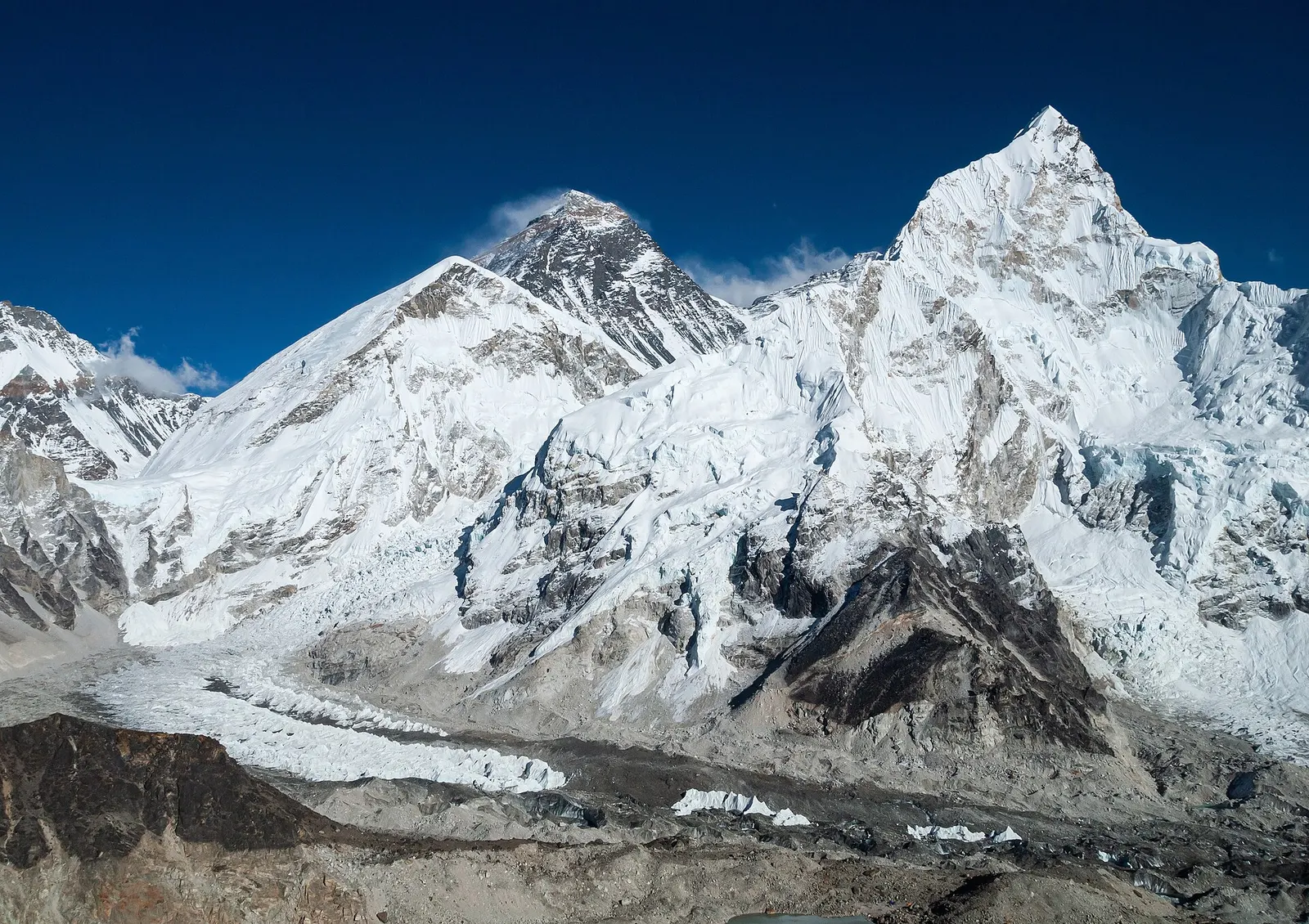
The classic teahouse trek from Lukla through Sherpa villages to Everest Base Camp (5,364 m) and the Kala Patthar viewpoint, with acclimatisation days in Namche and Dingboche.
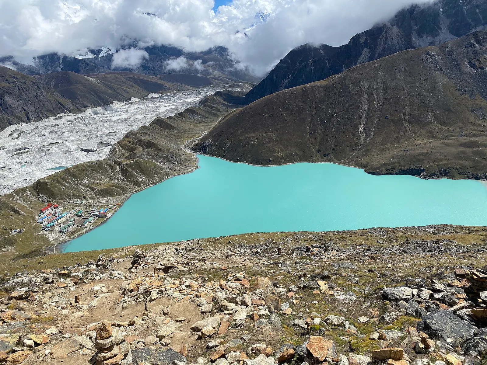
A teahouse trek from Lukla up the Dudh Kosi valley to the turquoise Gokyo Lakes beside the Ngozumpa Glacier, with a dawn climb of Gokyo Ri (about 5,357 m) for views of four 8,000 m peaks.
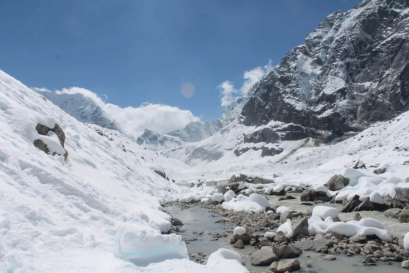
A network of high and mid-hill routes about 1,700 km long that crosses Nepal from Kanchenjunga in the east to Humla and the far west, usually walked in sections, or as a through-trek of about four to five months.
Most people fly to Lukla, from Kathmandu or from Ramechhap in busy seasons, then walk. A longer alternative is a jeep to lower Solukhumbu followed by 2-3 days on foot.
Yes. Foreign trekkers need a Sagarmatha National Park permit and the Khumbu Pasang Lhamu Rural Municipality permit; check the current rules on guides and TIMS before you go.
October to November and March to May are the main seasons. Winter is cold but clear, and the monsoon months bring rain and flight delays.
Yes. Base camp is at about 5,360 m and most routes go above 4,000 m, so a slow ascent with acclimatisation days is essential.
No. Lukla and Phakding are in the buffer zone; the park and World Heritage Site begin near Monjo, a few hours north.
No. It is a walking trek with no technical climbing. What matters is steady fitness for several days of 5 to 7 hours on foot, and a slow ascent with rest days so your body can adjust to the altitude.
Sometimes. In the peak spring and autumn seasons, many Lukla flights operate from Manthali in Ramechhap instead, which means a 4 to 5 hour drive from Kathmandu, often leaving in the early hours. Check with your airline or operator.
On a clear day Everest is visible from points above Namche Bazaar, about two days' walk from Lukla, and from Tengboche. A mountain flight from Kathmandu is the option that involves no trekking.
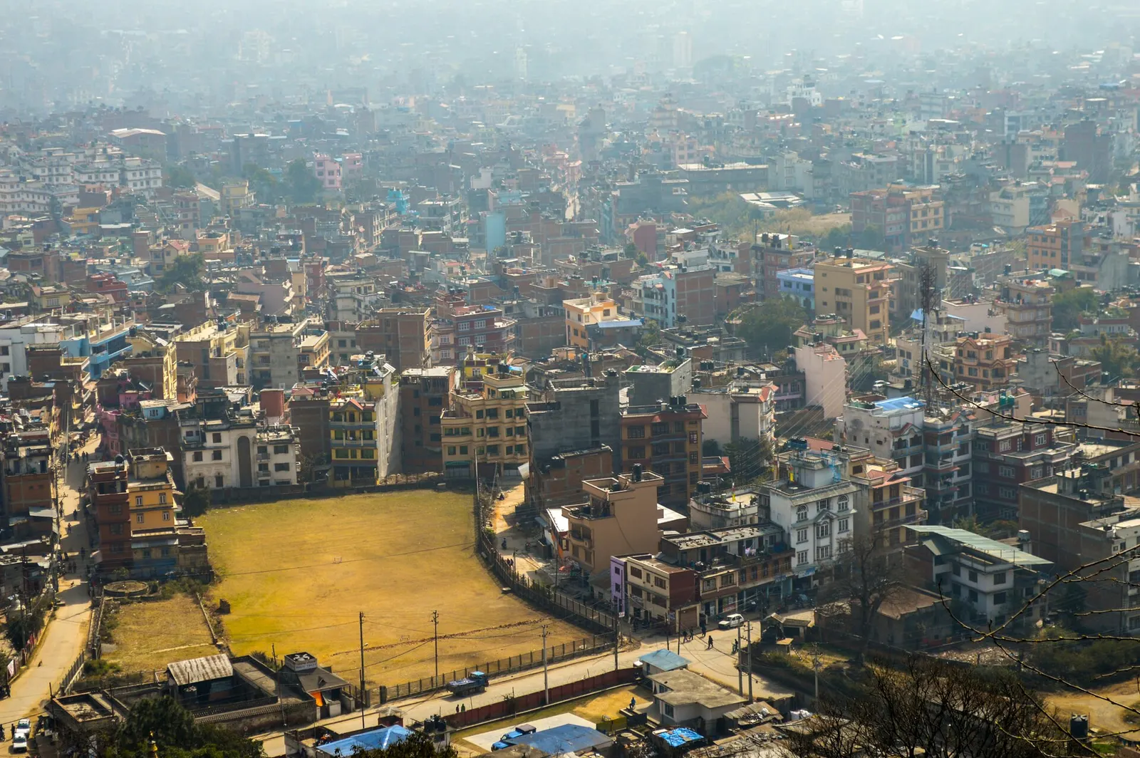
Town or village · 1,400 m
Nepal's capital, a sprawling valley city wrapped around a medieval Newar core, with major Hindu and Buddhist sites and the country's main airport.
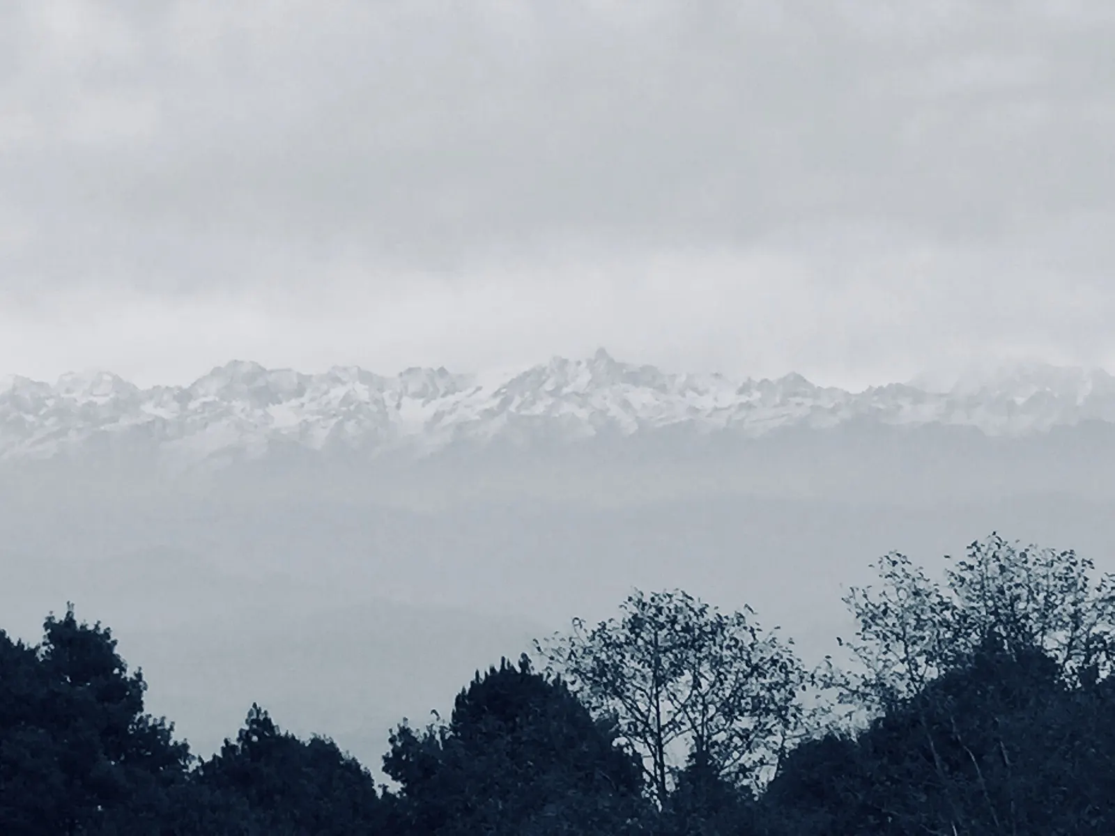
Viewpoint · 2,175 m
A ridge-top village on the eastern rim of the Kathmandu Valley, known for sunrise views across the Himalaya.