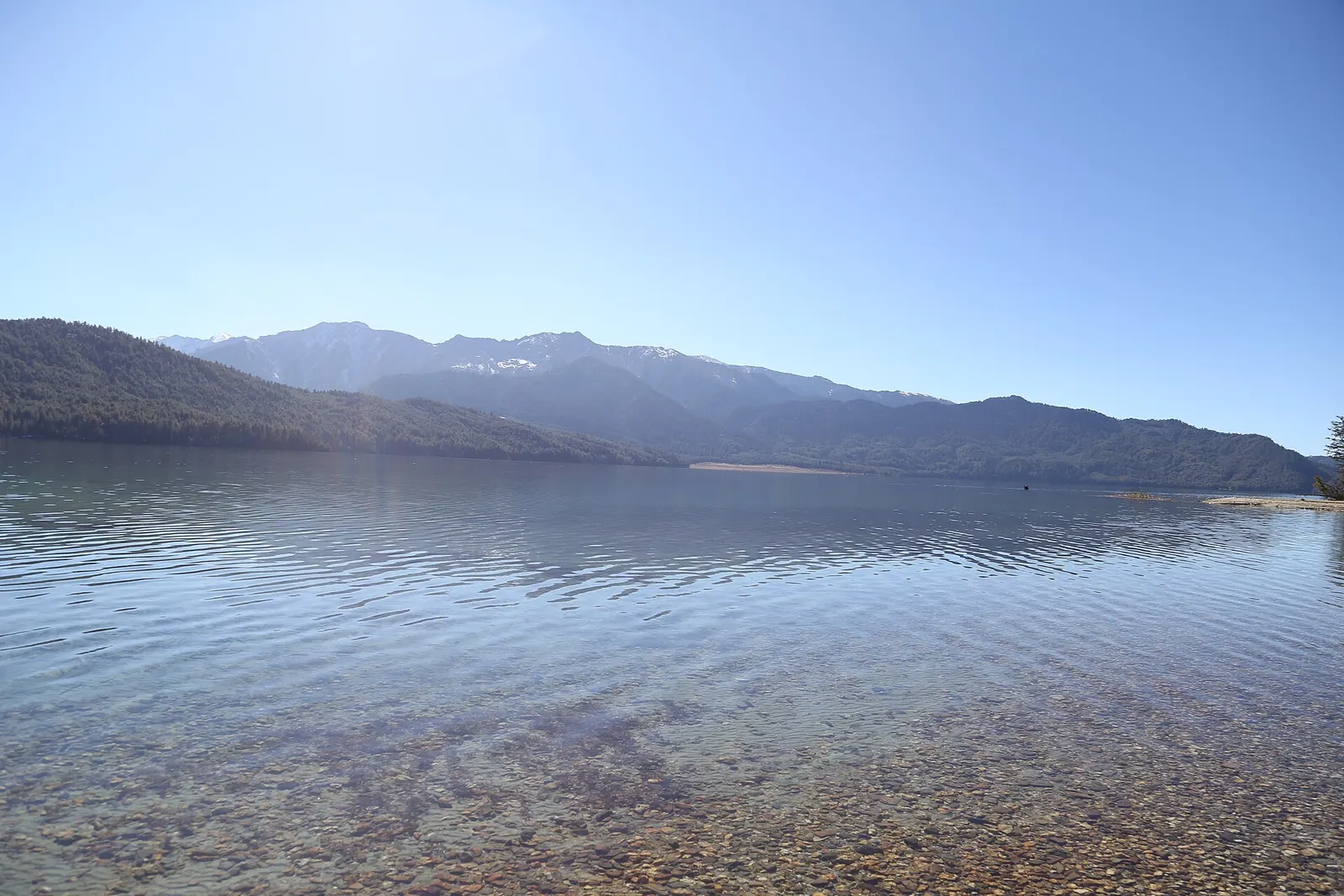
A week-long walk in remote Karnali from Jumla through the Sinja valley to Rara Lake, Nepal's largest lake, at about 2,990 m in Rara National Park, usually ending with a flight from Talcha.
- Days
- 8 days
- Maximum altitude
- 3,630 m
- Difficulty
- Moderate
Rara Lakeजुम्ला
A highland bazaar town in the Tila valley of Karnali, known for red rice and apples and used as the starting point for the trek to Rara Lake.
This is Jumla town (Khalanga), the headquarters of Jumla district in Karnali Province, the usual start of the trek to Rara Lake.
Higher seasonal exposure: landslides (Jun-Sep), road blockages (Jun-Sep).
Jumla is the headquarters town of Jumla district, at about 2,500 m in the Tila valley of Karnali Province. The town, also called Khalanga, has an airport with flights from Nepalgunj, government offices, shops and simple hotels, and it is the usual start of the walk to Rara Lake, which lies three to five days to the north in neighbouring Mugu district.
Around the town, terraced fields grow Jumli Marsi, a cold-tolerant red rice cultivated here at altitudes of up to about 3,000 m, as well as apples and walnuts. The Chandannath temple stands in the bazaar, and the valley opens towards the Sinja valley to the north-west. Roads now reach Jumla from Surkhet along the Karnali Highway, but flying remains the quicker option.
For trekkers, a night in Jumla is usually spent sorting gear, meeting the trekking crew and buying last supplies, since shops along the route to Rara are few and small. The town is also a base for longer journeys deeper into Karnali, including routes towards Dolpo to the east and Mugu and Humla to the north, and for visits to the old temples and stone pillars of the Sinja valley, a day or two away on foot.
The Jumla area was part of the Khas Malla kingdom, whose capital lay in the nearby Sinja valley from about the 12th to 14th centuries; the Khas language from this region is an ancestor of modern Nepali. Jumla later became a small hill kingdom before joining the unified state in the late 18th century. The Chandannath temple and the nearby Bhairab temple are the main religious sites in town, and the population is largely Chhetri, Thakuri and Brahmin, with Dalit communities.
Chandannath temple
Visit the temple in the town centre; remove shoes where asked and follow local customs.
Start the Rara Lake trek
Walk north via Chere Chaur and the Sinja valley, or the more direct route via Padmara and Pina, to reach Rara in 3-5 days.
Forecast for 2,514 m. Conditions change fast in the mountains.
Weather data: MET Norway, licensed CC BY 4.0. A forecast, not a guarantee.
Mar-May, Sep-Nov
Simple hotels and guesthouses in the bazaar.
No partner stays are listed here yet. List a property.
Fly from Nepalgunj to Jumla, or travel by road along the Karnali Highway from Surkhet.
Nearest hub: Nepalgunj
Nearest hub: Nepalgunj. Times are typical ranges, not schedules, and vary with roadworks, weather and the season.
By airfrom Nepalgunjabout 0.5-0.8 hJumlaoften delayed or cancelled by weather
Several carriers fly small aircraft Nepalgunj to Jumla, one of the remote western airstrips Nepalgunj exists to serve; the leg is weather-dependent.
When to set off: Morning flights; most travellers fly Kathmandu to Nepalgunj first and stay overnight.
By busfrom Surkhet (Birendranagar)about 12-30 hLocal buses
Local buses work the Karnali Highway from Surkhet, slowly and over a largely unpaved alignment. Timings vary widely and monsoon landslides are a recurring problem.
When to set off: Buses leave Surkhet early; many passengers break the journey overnight.
By car or jeepfrom Surkhet (Birendranagar)about 12-30 h
The Karnali Highway runs north from the Terai through Surkhet to Jumla and beyond. Only a short stretch was blacktopped as of 2010 and most of it is an unpaved mountain track, so the drive is slow; sources put the Surkhet-Jumla run anywhere between about half a day and more than two days. It is the route to Jumla for anyone not flying.
Road: Largely unpaved mountain highway with long exposed sections; a 4WD or a rugged bus is needed, and monsoon landslides are a recurring problem.
When to set off: Vehicles leave Surkhet early in the morning, and the drive is commonly broken overnight on the way.
By motorbikefrom Surkhet (Birendranagar)Experienced riders only
Ridden by some, but the Karnali Highway is mostly unpaved, remote and exposed, with little fuel or help between towns.
Road: Largely unpaved mountain highway, remote and exposed, with long gaps between fuel stops.
None needed
No permit is needed for Jumla town. Treks to Rara need a Rara National Park entry permit; check whether a TIMS card is currently required.
Verify before travel: permit rules and fees change. Checked 2026-10-06 against Department of National Parks and Wildlife Conservation.
On the Rara Lake trek.
What this place is typically exposed to, and when. These are seasonal patterns, not a report on conditions now.
Landslideshigh in a typical yearJun-Sep
The Karnali Highway up from Surkhet is largely unpaved and monsoon landslides have closed it for long stretches in the past, including a three-month closure in 2010.
Road blockageshigh in a typical yearJun-Sep
Treat the Surkhet-Jumla road as unreliable from June to September and plan generous margins; the dry months are far more dependable.
Othermoderate in a typical yearJun-Sep
Jumla is served by small aircraft from Nepalgunj, the hub for the remote western airstrips, and monsoon cloud regularly delays these flights.
Snowmoderate in a typical yearDec-Mar
Snow falls in Jumla at about 2,500 m in midwinter and lies on the passes north towards Rara, where trails and the road can be blocked.
Coldmoderate in a typical yearDec-Feb
December to February is cold at about 2,500 m, with hard frosts and short days.
Check current conditions before you travel
Roads, trails, passes and flights change with the weather and with roadworks, and nothing on this page describes conditions today. Before you set off, check the Department of Hydrology and Meteorology for weather and flood warnings, the Nepal Disaster Risk Reduction Portal for incidents, and the local authority, police or your licensed operator for road, trail and flight status.
A week-long walk in remote Karnali from Jumla through the Sinja valley to Rara Lake, Nepal's largest lake, at about 2,990 m in Rara National Park, usually ending with a flight from Talcha.
Most visitors fly from Kathmandu to Nepalgunj and then take a short flight to Jumla. A road also links Jumla with Surkhet along the Karnali Highway.
About 3-5 days on foot depending on the route, or a long jeep ride on rough roads.
About 2,500 m; the town is given as 2,514 m and the airport at about 2,347 m.
Lake · 2,990 m
Nepal's largest lake, a deep blue sheet of water ringed by pine forest in the remote Karnali hills.
Valley or region
A remote trans-Himalayan region of Bon and Buddhist villages, high passes and turquoise Phoksundo Lake, behind the Dhaulagiri and Kanjiroba ranges.
Valley or region · 3,700 m
A remote, high valley in northern Humla on the Tibetan border, with three Tibetan Buddhist villages and an 11th-century monastery.
National park or conservation area · 3,000 m
A high, rolling plateau of grassland and forest in Nepal's far west, known for its wildflower meadows and the hermitage of Khaptad Baba.