
Valley or region
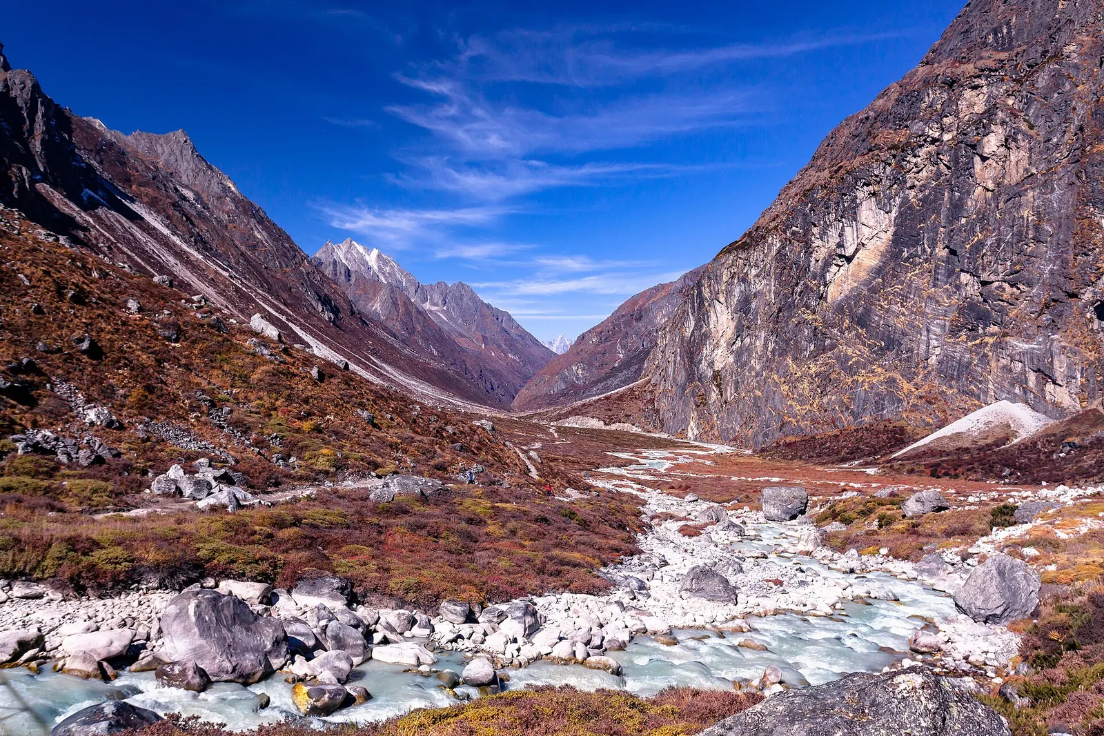
Rolwaling Valley
A remote Sherpa valley under Gaurishankar in Dolakha, trekked to the glacial lake Tsho Rolpa, with a technical pass to the Everest region.
Dolakhaदोलखा भीमसेन मन्दिर
An open-roofed temple in the old Newar town of Dolakha, where a triangular stone image of Bhimsen is worshipped as a god of trade and fortune.
This is the Bhimsen temple in the old town of Dolakha near Charikot, not the Bhimsen temples of Kathmandu or Patan.
Higher seasonal exposure: road blockages (Jun-Sep).
The Dolakha Bhimsen temple stands in the old town of Dolakha, about 4.5 km east of Charikot in Bhimeshwar Municipality, and gives the municipality its name. It is one of the most visited temples in eastern Bagmati Province, with thousands of worshippers each week, many of them traders and business families who come to ask for prosperity.
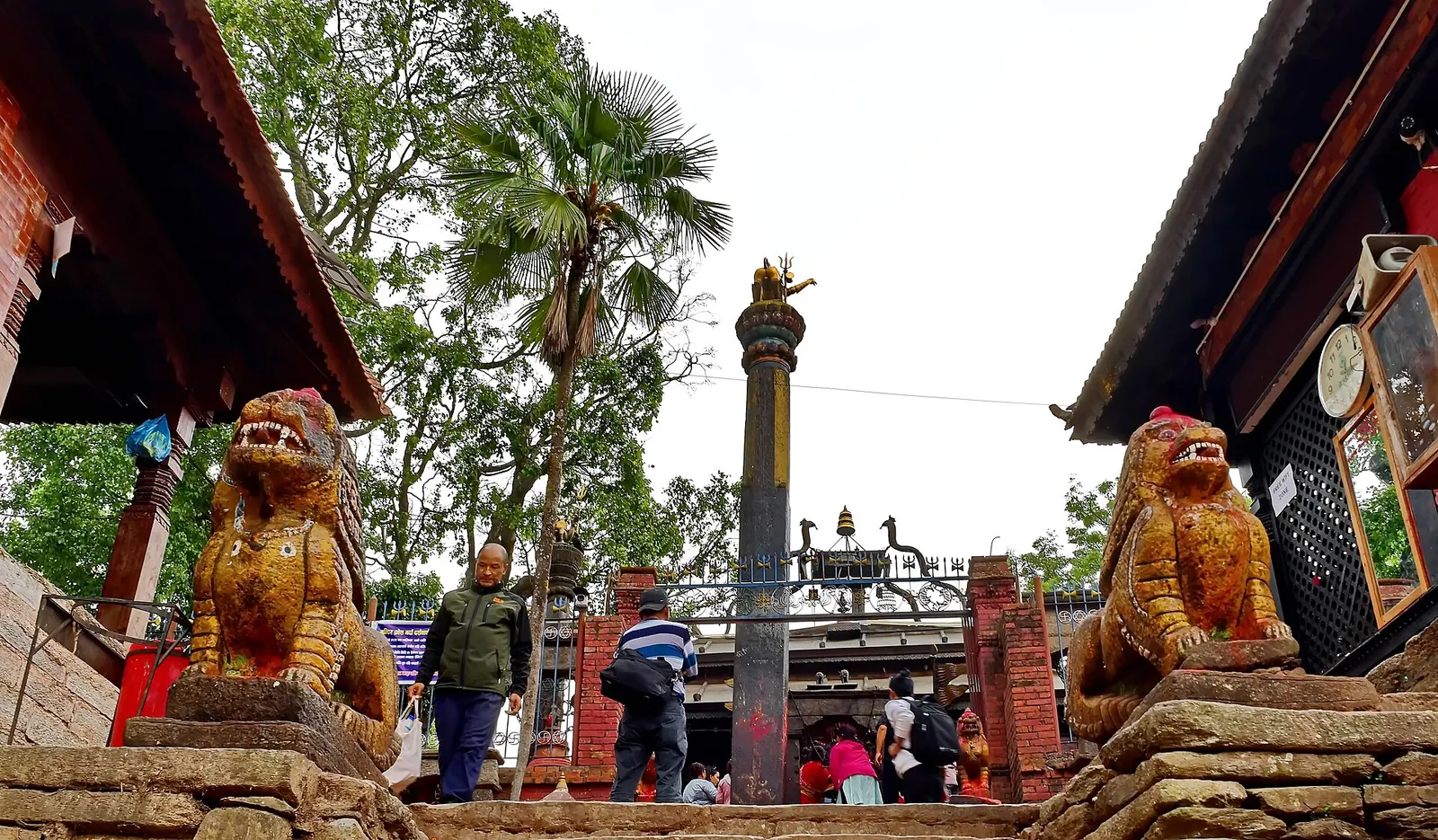
Unusually, the temple has no roof over the main image: the deity is a natural, roughly triangular black stone under the open sky, surrounded by a courtyard, carved wooden shelters, bells and offerings. Stone lions guard the entrance steps and a tall pillar topped with an emblem stands in front of the gate. The surrounding bazaar keeps Newar houses, stone-paved lanes and other shrines, including the Tripurasundari temple.
Within the Dolakha hub, the temple is an easy half-day stop from Charikot and is often visited on the way to or from Kalinchowk.
Bhimsen, called Bhindyo by Newars, is worshipped as the patron of trade, commerce and good fortune. Some identify him with Bhima of the Mahabharata; local tradition says the Pandava brothers spent part of their exile in Dolakha. The stone is said to appear as Bhimeshwar in the morning, Mahadev (Shiva) during the day and Narayan in the evening.
A local legend tells of porters who used three stones as a cooking stove; when one man struck a stone that kept their rice from cooking, it bled, and the stone was recognised as Bhimsen. The founding date is unknown, but an inscription from 1611 records a renovation. The image is believed to 'sweat' before national misfortunes, and such events have been reported several times, most recently in 2020; this is a matter of faith rather than documented cause and effect.
Visit the temple
Join the flow of worshippers in the courtyard; non-Hindus can usually watch from the courtyard, but check locally before entering inner areas.
Walk the old town
Explore Dolakha's lanes, old houses and the Tripurasundari temple in an hour or two.
Combine with Kalinchowk
Stop at the temple on the drive between Charikot and Kalinchowk.
Forecast for 972 m. Conditions change fast in the mountains.
Weather data: MET Norway, licensed CC BY 4.0. A forecast, not a guarantee.
Feb-Apr, Oct-Dec
Most visitors stay in Charikot, which has hotels and guesthouses; there are a few simple options in Dolakha bazaar.
No partner stays are listed here yet. List a property.
The temple is about 4.5 km east of Charikot by road, which is about 5-7 hours from Kathmandu.
Nearest hub: Charikot
Nearest hub: Dolakha. Times are typical ranges, not schedules, and vary with roadworks, weather and the season.
By busfrom Kathmanduabout 5-7 hTourist and local buses
Take a Charikot bus (133 km, about six hours), then local transport for the last few kilometres east to Dolakha bazaar.
When to set off: Charikot buses leave Kathmandu in the morning.
Kalinchowk destination guide (Government of Nepal, film.gov.np)
By car or jeepfrom Dolakhaabout 0.25-0.5 h
A short sealed hill drive of about 4.5 km east from Charikot to the old Dolakha bazaar.
Road: Short sealed hill road from Charikot; easy in any vehicle outside heavy monsoon rain.
Kalinchowk destination guide (Government of Nepal, film.gov.np)
By motorbikefrom Dolakhaabout 0.25-0.5 hEasy riding
An easy short ride from Charikot.
Road: Short sealed hill road from Charikot.
Kalinchowk destination guide (Government of Nepal, film.gov.np)
On footfrom Dolakhaabout 1-1.5 hAbout 1-1.5 h from Charikot on road and village paths
A walk of about an hour from Charikot along the road and village paths.
When to set off: Walk in the morning or late afternoon to avoid the midday sun on the open road.
Kalinchowk destination guide (Government of Nepal, film.gov.np)
None needed
No permit or entry fee is required; donations are welcome.
Verify before travel: permit rules and fees change. Checked 2026-10-06 against Dolakha Bhimsen Temple (Wikipedia).
What this place is typically exposed to, and when. These are seasonal patterns, not a report on conditions now.
Road blockageshigh in a typical yearJun-Sep
Monsoon slides on the Araniko Highway and the Lamosangu to Jiri road can hold up or divert vehicles for anything from hours to weeks; a 2014 slide closed the highway for 46 days.
Landslidesmoderate in a typical yearJun-Sep
The Araniko Highway corridor used to reach Charikot runs under very steep, slide-prone hillsides, so monsoon travel to the temple can be delayed.
Coldlow in a typical yearDec-Feb
Winter days in the old bazaar are clear and cool rather than severe; the cold belongs to the high ground above.
Kalinchowk destination guide (Government of Nepal, film.gov.np)
Check current conditions before you travel
Roads, trails, passes and flights change with the weather and with roadworks, and nothing on this page describes conditions today. Before you set off, check the Department of Hydrology and Meteorology for weather and flood warnings, the Nepal Disaster Risk Reduction Portal for incidents, and the local authority, police or your licensed operator for road, trail and flight status.
In the old town of Dolakha, about 4.5 km east of Charikot, the headquarters of Dolakha District.
The deity is a natural stone worshipped under the open sky; the open-roofed sanctum is part of local tradition.
Devotees believe the stone image sweats before national misfortunes, and priests perform rituals when this is reported. It is a matter of faith.
Valley or region
A remote Sherpa valley under Gaurishankar in Dolakha, trekked to the glacial lake Tsho Rolpa, with a technical pass to the Everest region.
Temple, monastery or heritage site · 3,842 m
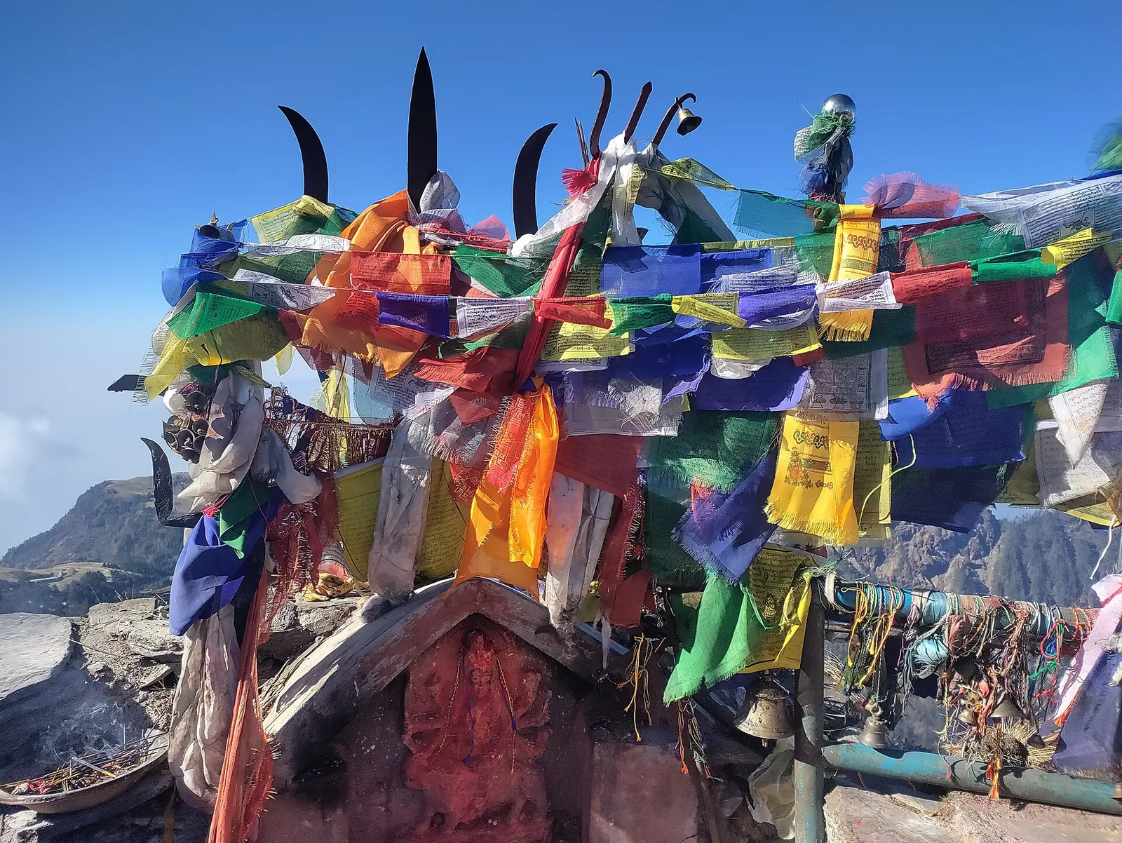
A Hindu shrine on a 3,842 m ridge in Dolakha, reached from Kuri on foot or by cable car, known for winter snow and mountain views.
Viewpoint · 3,146 m
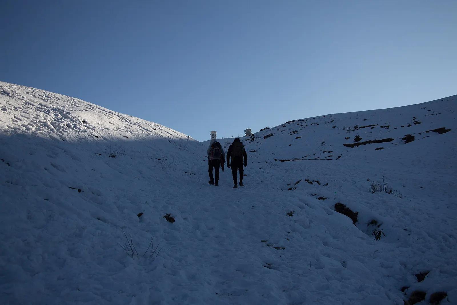
A high ridge of grassy domes on the Dolakha-Ramechhap border, with a wide Himalayan view and a hilltop Shiva shrine.
Valley or region
A hill district east of Kathmandu between the Tamakoshi gorges and the Gaurishankar range, with snow pilgrimages, an old Newar town and high trekking valleys.